Updated severe t-storm watch for parts of southern Minnesota Saturday evening
The National Weather Service has removed several southern Minnesota counties from the severe t-storm watch.
The watch continues until 9 p.m. Saturday for southwestern Minnesota and parts of far southeastern Minnesota:

There is also a flash flood warning until 7:45 p.m. this Saturday for portions of Mower and Fillmore counties in southeastern Minnesota:
Create a More Connected Minnesota
MPR News is your trusted resource for the news you need. With your support, MPR News brings accessible, courageous journalism and authentic conversation to everyone - free of paywalls and barriers. Your gift makes a difference.
Flash Flood Statement
National Weather Service La Crosse WI
503 PM CDT Sat Jun 15 2019
MNC045-099-160045-
/O.CON.KARX.FF.W.0002.000000T0000Z-190616T0045Z/
/00000.0.ER.000000T0000Z.000000T0000Z.000000T0000Z.OO/
Mower MN-Fillmore MN-
503 PM CDT Sat Jun 15 2019
...THE FLASH FLOOD WARNING REMAINS IN EFFECT UNTIL 745 PM CDT FOR
SOUTHERN MOWER AND WESTERN FILLMORE COUNTIES...
At 502 PM CDT, local law enforcement reported flash flooding across
portions of eastern Mower County. Up to three inches of rain have
already fallen. Flash flooding is already occurring.
Some locations that will experience flooding include...
Spring Valley, Grand Meadow, Le Roy, Adams, Lyle, Wykoff, Rose Creek,
Washington, Racine, Cherry Grove, Dexter, Ostrander, Elkton, Chester,
Taopi, County Roads 4 And 8, I 90 Exit 183, Highways 63 And 16,
Hamilton and Johnsburg.
PRECAUTIONARY/PREPAREDNESS ACTIONS...
Turn around, don`t drown when encountering flooded roads. Most flood
deaths occur in vehicles.
Stay away or be swept away. River banks and culverts can become
unstable and unsafe.
Rain and thunder update
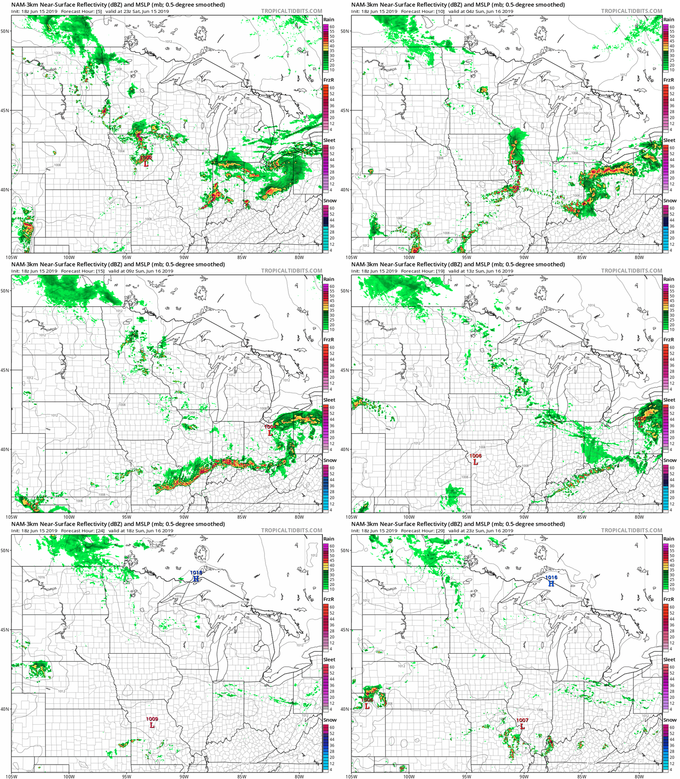
The National Oceanic and Atmospheric Administration’s North American Mesoscale forecast model shows the potential rain pattern from Saturday evening through Sunday afternoon:

The color chart to the right of the loop refers to the strength of the signal that returns to the radar, not to the amount of rain. Showers and thunderstorms are possible in some areas that look dry in the NAM loop, but the loop shows the general rain pattern within the model. You can see that we could also have a few scattered morning showers in Minnesota and western Wisconsin on Sunday, they could linger into the afternoon to the northwest.
You can see the recent local images from the local NWS radar here. The recent radar loop for southwestern Minnesota can be found here. The southeastern Minnesota radar loop can be found here.
As always, updated weather information can be heard on the Minnesota Public Radio Network, and you’ll also see updated weather info on the MPR News live weather blog.
Programming note
You can hear my live weather updates on Minnesota Public Radio at 7:49 a.m. Thursdays and Fridays, and at 7:35 a.m., 9:35 a.m. and 4:35 p.m. each Saturday and Sunday.