Some showers and t-storms at times on Sunday; a shot at 90 next week?
Most of us made it through the bulk of Saturday without getting rained on. We probably won't be as lucky on Sunday; there are some off and on showers and thunderstorms in the Sunday forecast. So it goes in Minnesota during June.
Rain and thunder prospects
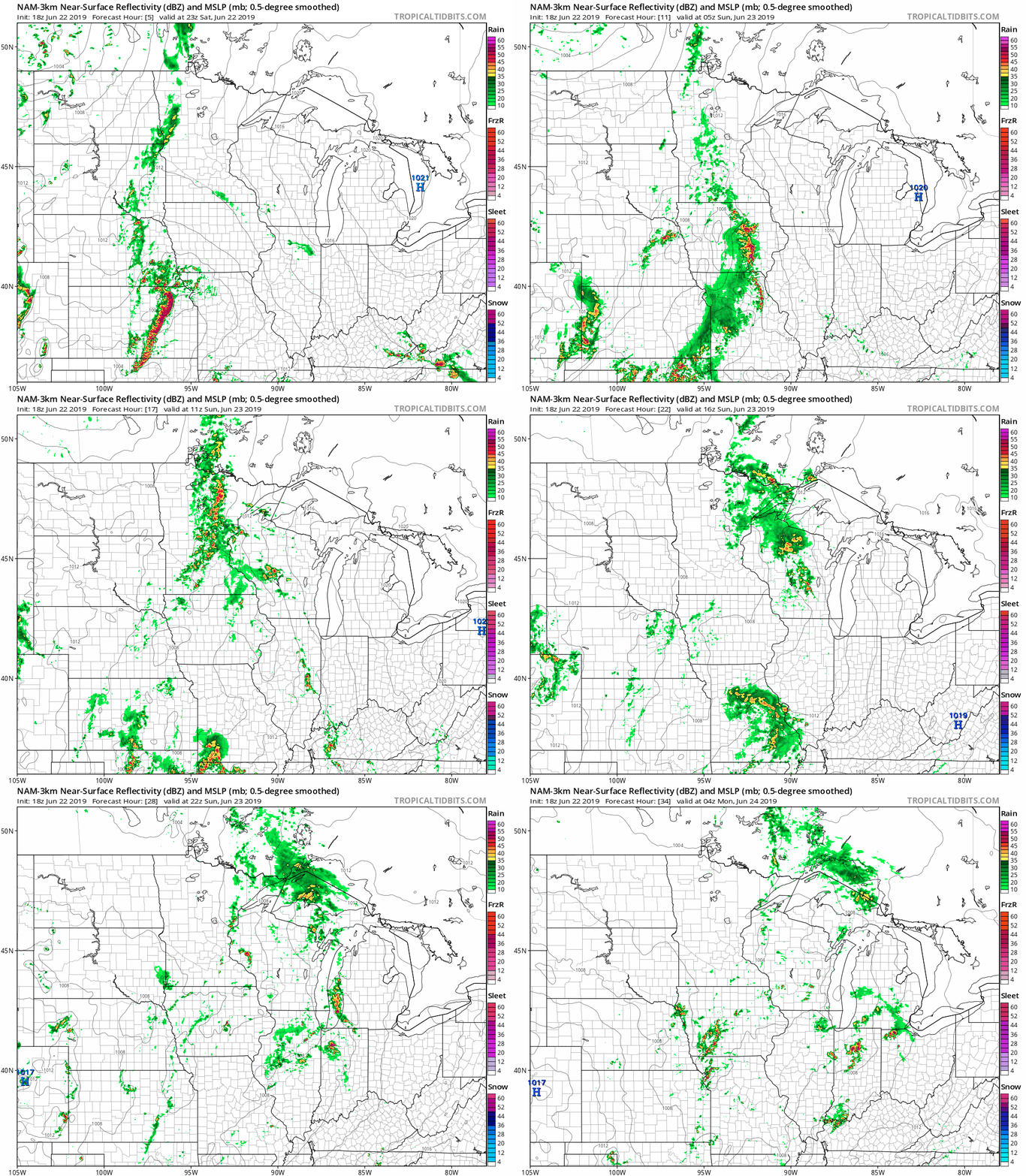
Areas of rain, with embedded thunderstorms, will spread across much of Minnesota and western Wisconsin overnight Saturday night, then linger in some areas on Sunday.
The National Oceanic and Atmospheric Administration's North American Mesoscale forecast model shows the potential rain pattern Saturday evening through Sunday evening:
Create a More Connected Minnesota
MPR News is your trusted resource for the news you need. With your support, MPR News brings accessible, courageous journalism and authentic conversation to everyone - free of paywalls and barriers. Your gift makes a difference.

The color chart to the right of the loop refers to the strength of the signal that returns to the radar, not to the amount of rain. It will rain in some areas that look dry in the NAM loop, but the loop shows the general rain pattern within the model.
As always, updated weather information can be heard on the Minnesota Public Radio Network, and you’ll also see updated weather info on the MPR News live weather blog.
You can see the recent local NWS radar loop here. The recent radar loop for southwestern Minnesota can be found here, and the southeastern Minnesota loop here. The northeastern Minnesota radar loop and the northwestern Minnesota radar loop are also available.
Severe weather outlook
The Storm Prediction Center of the National Weather Service shows a marginal risk of severe weather for much of the southern half of Minnesota plus southwestern Wisconsin this Saturday evening and through the overnight hours of Saturday night. Several counties in far southern Minnesota are in the SPC slight severe weather risk category for that same period:

Marginal risk means that an isolated severe thunderstorm is possible, while slight risk means that scattered severe t-storms are possible:
You can check the SPC site for outlook updates.
Temperature trends
The Saturday high temperature at Minneapolis-St. Paul International Airport was 79 degrees, which was just two degrees shy of our average high temp for the date.
Much of Minnesota plus western Wisconsin will see highs in the 70s on Sunday, with 60s to the northeast:

Twin Cities metro area highs are projected to reach the upper 70s on Monday, followed by lower 80s Tuesday and mid 80s on Wednesday. We have a good shot at highs in the upper 80s Thursday and Friday. I wouldn't be surprised to see a stray 90 degree reading in the metro area on Thursday and/or Friday.
The NWS Climate Prediction Center indicates that warmer than normal temps are likely in Minnesota next weekend into the first couple of days of July:

Highs in the 90s
We've only seen one day with a high of 90 degrees or higher at MSP airport this year, reaching exactly 90 on June 7. We average 10.6 days per year with a high of 90 degrees or warmer in the Twin Cities:

It's still early in our warm season. We only average about two days with highs of 90 degrees or higher during the month of June. July is our warmest month, with an average of about five days with high temps of 90 or warmer.
Programming note
You can hear my live weather updates on Minnesota Public Radio at 7:49 a.m. Thursdays and Fridays, and at 7:35 a.m., 9:35 a.m. and 4:35 p.m. each Saturday and Sunday.