Tornado near Redwood Falls: Widespread 1″ to 3″ totals by Monday
A few storms turned severe in southwest Minnesota Thursday afternoon. This tornado was captured on the ground south of Redwood Falls.
78 mph wind gusts and golf ball sized hail was reported in St. James.
Rain returns
Create a More Connected Minnesota
MPR News is your trusted resource for the news you need. With your support, MPR News brings accessible, courageous journalism and authentic conversation to everyone - free of paywalls and barriers. Your gift makes a difference.
Our string of mostly dry days for much of Minnesota is over. MSP Airport tallied just .54" of rain in June through the 19th.
Widespread rain and a few thunderstorms returned as expected Thursday. A series of slow-moving low-pressure systems will keep rain in the forecast into Monday.
The rain first waves move through into Thursday evening. Look for just spotty shower coverage late tonight.
Active pattern
Today's rain waves are the first of several over the next few days. There will be many dry hours through the weekend, but also occasional rounds of rain and thunder.
The best chance for rain appears to favor Friday night into Saturday, then again Sunday night into Monday. But model spread on timing and coverage this weekend is considerable.
Here's the Canadian model.

Severe risk Friday afternoon and evening
There is s alight risk for the southwest half of Minnesota Friday. A marginal (low) risk extends east into St. Cloud and the Twin Cities. The highest risk for severe storms with hail and damaging winds favors Friday evening in western Minnesota.

Couple inches?
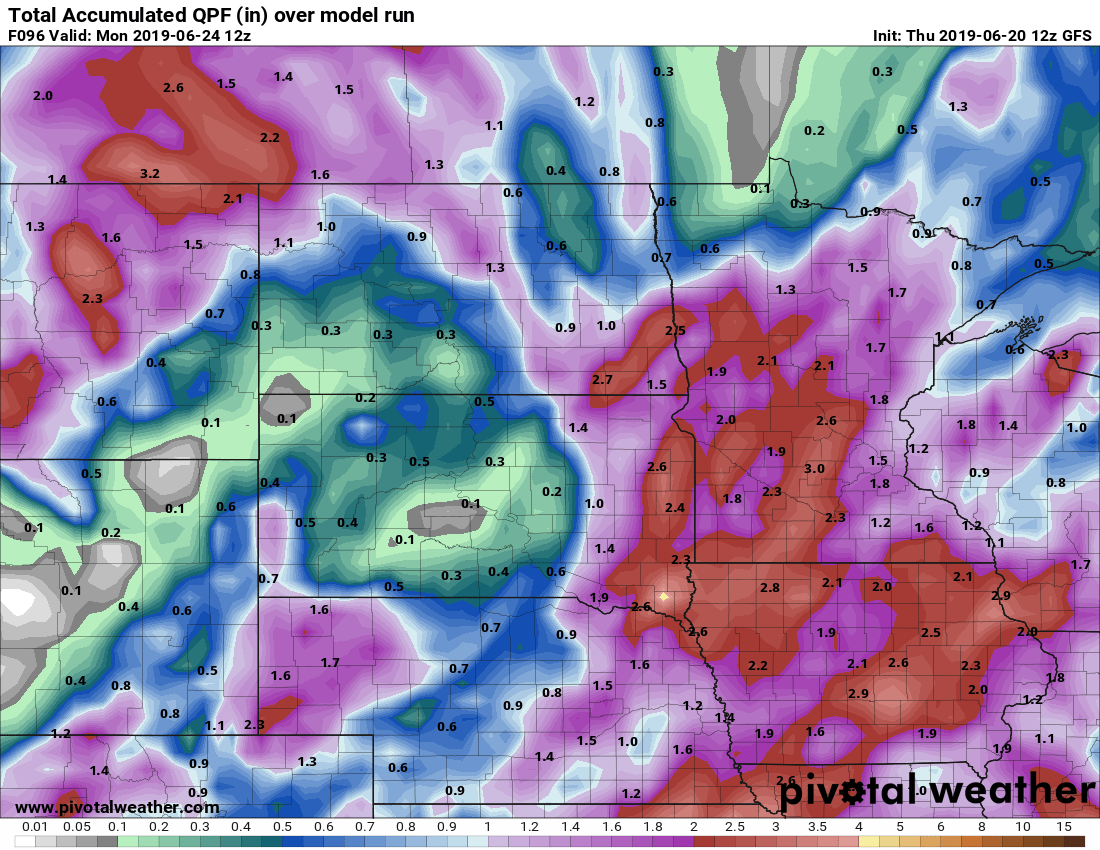
Again, there is wide model spread on rainfall totals through this weekend. But widespread totals around an inch looks likely. And the latest model runs feature wider areas with 2" to 3"+ totals. So this will be a serious soaking for some communities by late Monday.
Here's NOAA's GFS model rainfall output through Monday morning.
Warmer next week
It feels like I've been saying that now for a month. And temperatures have nudged reluctantly higher. It's baby steps into summer this year. But next week looks like a giant leap.
Finally.
