Milder with spotty showers Friday; is NOAA’s GFS model upgrade any better?
It was a beautiful but cool Thursday across Minnesota.
Temperatures started out below freezing in the colder nooks and crannies up north. Hibbing set a new record at 28 degrees. Crane Lake also bottomed out at 28.
Warmer Friday
Warmer breezes blow Friday. Highs in southern Minnesota favor the upper 70s to near 80 degrees. Temperatures bounce around mostly through the 70s into next week.
Create a More Connected Minnesota
MPR News is your trusted resource for the news you need. With your support, MPR News brings accessible, courageous journalism and authentic conversation to everyone - free of paywalls and barriers. Your gift makes a difference.

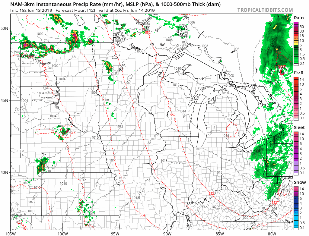
Dodging showers
It's interesting to note there are still significant model differences in the timing and coverage of showers the next few days. The early read favors scattered showers and T-Storms moving across northern Minnesota overnight into Friday morning. A few models suggest the best chance for scattered T-Showers will bubble up in the Twin Cities Friday evening.
Here's NOAA's NAM 3 km resolution model between 1 am and 11 pm Friday.
Most forecast models suggest a mix of dry hours and a few showers Saturday and Father's Day.
NOAA GFS model upgrade: Jury is out
NOAA's long-planned and delayed upgrade to its flagship numerical forecast model is here. The Global Forecast System (GFS) has a new "dynamical core." The GFS-FV3 has been running in parallel alongside its predecessor. The new model has scored some victories, and also shows some biases. Some meteorologists are not yet sold on the model as an improvement.
The new GFS appears to have a "cold bias." It's being addressed, but a cold bias of even a couple degrees can wreak havoc on snowfall forecasts in the Upper Midwest where we live. The new GFS-FV3 also appears to move weather systems in the mid-latitudes (where we live) too fast. For those of us who forecast operationally in winter, a model that's too cold, and too fast can really mess with snowfall timing and forecast totals in winter storms.
Here's a clip on some of the issues and the reaction to the GFS FV3 from Science News.
Over the winter, meteorologists who have kept an eye on the model’s predictions (publicly available since March 2018) worried aloud on social media sites such as Twitter that the model isn’t ready to take over as the primary U.S. weather-prediction tool. “Scary that this is what we are about to go with on a permanent basis,” tweeted Doug Kammerer, chief meteorologist for NBC Washington, on February 13.
Following this criticism, the launch date was postponed for several months again. On April 4, government scientists released a new configuration of the FV3 model that they said removed the cold bias and “showed a clear improvement” in excessive snowfall predictions. But the model still predicted somewhat more snowfall than was observed in some of its test cases, such as the January 2019 cold snap in the Northeast.
“That’s one of the problems we will continue to work on,” said Brian Gross, director of NOAA’s Environmental Modeling Center, during a news conference June 12 to announce the launch.
Another problem that scientists have identified, and that meteorologists should be aware of when doing their forecasts, is that the new model tends to predict that weather patterns in the mid-latitudes will move a bit faster than they actually do, Gross said. “It’s something to look out for as we continue to work on that feature.”
For now, scientists are reserving judgment. “I believe that most of the overprediction of snow has been taken care of,” says Cliff Mass, an atmospheric scientist at the University of Washington in Seattle who has been watching the evolution of the model.
We're #3
NOAA's GFS model has been the 3rd most accurate forecast model on the planet. The ECMWF and UKMET models show more skill overall.
I've noticed today's forecast for weekend temperatures in the Twin Cities are considerably colder on the GFS than other models. For now, this forecaster remains in the skeptical camp on how good the news GFS-FV3 will be for Minnesota. I'll be watching the ECMWF, Canadian, and NAM models closely and comparing them to the GFS before buying in.
Stay tuned.