Cooler temps Sunday, with a chance of showers; a lot of 70s in the coming week
Most of Minnesota and Wisconsin enjoyed beautiful summery weather on Saturday. The high of 88 degrees at Minneapolis-St. Paul International Airport was 11 degrees warmer than our average June 8 high temp.
As expected, thunderstorms blossomed over northwestern Minnesota and parts of west-central Minnesota Saturday afternoon. Here's the Saturday afternoon satellite loop:
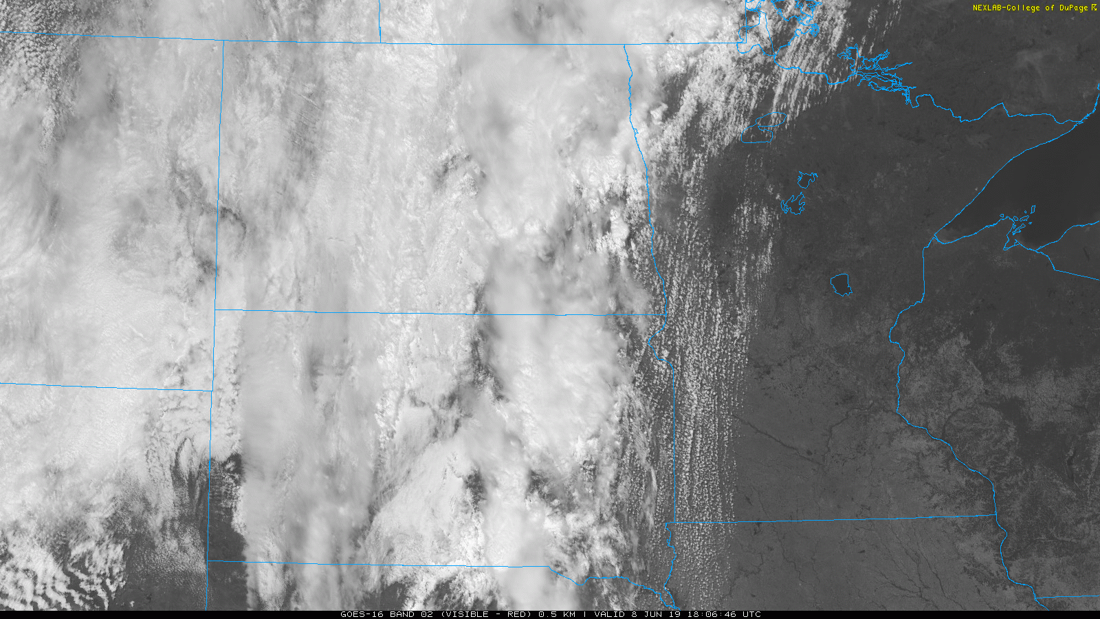
A severe thunderstorm watch was issued Saturday afternoon for northwestern Minnesota and parts of north-central Minnesota, and it was set to expire at 8 p.m. Saturday. There were several high wind reports in northwestern Minnesota Saturday afternoon. Updated watch information can be found on the NWS Storm Prediction Center site.
The thunderstorms were expected to spread to the east-northeast Saturday evening, then weaken and become more scattered late Saturday night. Much of Minnesota and western Wisconsin will see some showers at times on Sunday, with a thunderstorm also possible.
Create a More Connected Minnesota
MPR News is your trusted resource for the news you need. With your support, MPR News brings accessible, courageous journalism and authentic conversation to everyone - free of paywalls and barriers. Your gift makes a difference.
The National Oceanic and Atmospheric Administration's North American Mesoscale forecast model shows the potential rain pattern Saturday evening through Sunday evening:

It’ll rain in some areas that look dry in the simulated radar loop, but the loop illustrates the general rain pattern.
As always, updated weather information can be heard on the Minnesota Public Radio Network, and you’ll also see updated weather info on the MPR News live weather blog.
Cooler on Sunday
It felt like July Saturday afternoon. Sunday afternoon temps will remind us of May in some areas. Much of the northwestern half of Minnesota will have Sunday highs in the 60s, with 70s elsewhere:

Our average high temp is 77 degrees this time of year in the Twin Cities metro area.
Twin Cities metro area highs are projected to reach the mid 70s Monday and Tuesday, around 70 Wednesday, lower 70s Thursday and upper 70s Friday.
Programming note
You can hear my live weather updates on Minnesota Public Radio at 7:49 a.m. Thursdays and Fridays, and at 7:35 a.m., 9:35 a.m. and 4:35 p.m. each Saturday and Sunday.