A nice Sunday, filtered sunshine west; pleasant temps this coming week
Our Sunday will be rain-free in most areas. That's a welcome development for people dealing with soggy lawns, gardens and farm fields.
I'm sure that Grand Old Day participants in St. Paul will enjoy our Sunday weather.
Canadian wildfire smoke
The morning satellite pictures are showing a veil of smoke from Canadian wildfires covering much of west-central, southwestern and south-central Minnesota:
Create a More Connected Minnesota
MPR News is your trusted resource for the news you need. With your support, MPR News brings accessible, courageous journalism and authentic conversation to everyone - free of paywalls and barriers. Your gift makes a difference.
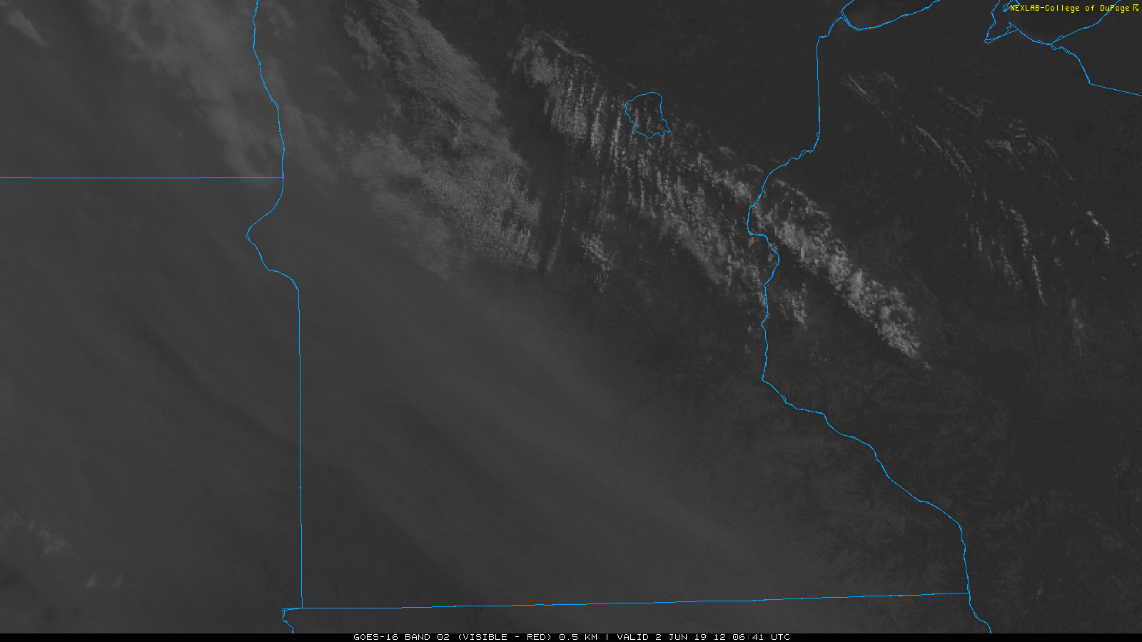
Those areas will have filtered sunshine today. One experimental forecast model shows the wildfire smoke spreading slowly eastward late Sunday afternoon and Sunday evening.
Air quality at ground level has been good this morning around Minnesota. You can check here for the latest air quality report from the Minnesota Pollution Control Agency.
Temperature trends
Most of Minnesota will see highs in the 70s Sunday afternoon. Highs will only reach the 60s in north-central and northeastern Minnesota and parts of western Wisconsin. There could be a few highs in the 50s along the North Shore of Lake Superior.
____________________________________________________
3:20 p.m. update
The NWS has issued a freeze warning for Lake and Cook counties of northeastern Minnesota from 11 p.m. Sunday to 8 a.m. Monday. A frost advisory for the same period covers most of St. Louis county (but not Duluth) and north-central Minnesota:

____________________________________________________
Monday highs will be well into the 70s in most areas:

Some spots in the Twin Cities metro area will touch 80 Monday afternoon.
Twin Cities metro area highs are projected to be around 80 Tuesday and Wednesday, followed by lower 80s Thursday and Friday.
Rain chances
There will be a chance of occasional showers and some embedded thunderstorms for Minnesota and western Wisconsin Tuesday and Tuesday night.
The National Oceanic and Atmospheric Administration’s Global Forecast System model shows the potential precipitation pattern from late Monday night through Wednesday morning:

The color chart to the right of the loop refers to the precipitation rate (mm per hour), not to the total amount of rain.
Sunniest time of year
Have your sunglasses ready. Our sunniest months of the year occur during meteorological summer.
Long-term Twin Cities climate data indicates that, based on percent of possible sunshine, June is our third-sunniest month of the year in the Twin Cities metro area:

We average 66% of possible sunshine in June. Our sunniest month of the year in the Twin Cities is July, with an average of 72% of possible sunshine. Our second-sunniest month of the year is August, with 69% of possible sunshine.
Programming note
You can hear my live weather updates on Minnesota Public Radio at 7:49 a.m. Thursdays and Fridays, and at 7:35 a.m., 9:35 a.m. and 4:35 p.m. each Saturday and Sunday.