Weather perfection Wednesday; bumpy storms ahead
In a year with plenty of stormy weather days, this is one to celebrate.
All weather is subjective, but 30-plus years working as a meteorologist in Minnesota tells me that 96.7 percent of all Minnesotans find Wednesday's weather pleasant, if not exceptional.
Bright blue skies, milder temperatures, and light winds are a good tonic for the weather-weary Minnesota soul this spring.
Get out there.
Create a More Connected Minnesota
MPR News is your trusted resource for the news you need. With your support, MPR News brings accessible, courageous journalism and authentic conversation to everyone - free of paywalls and barriers. Your gift makes a difference.

Cooler by the lake
After a warm start to the morning winds will turn off Lake Superior as colder, denser air pushes inland Wednesday afternoon. A classic lake breeze will hold temperatures in the 50s near Lake Superior.

Bumpy storms Wednesday night
The next low-pressure wave rides into Minnesota Wednesday night. Look for storms to develop in northwestern Minnesota, then rumble across northern Minnesota. Storms look likely to pop in and near the Twin Cities Thursday morning between 6 a.m. and 8 a.m.
I like the way the National Oceanic and Atmospheric Administration's NAM 3 km resolution model handles the coverage and timing of storms overnight into Thursday morning.

First 80 Thursday?
Many locations in southern Minnesota will see the first 80 degrees temperatures of the year Thursday. The Canadian model pushes temperatures to near 85 degrees in the southeast metro Thursday afternoon.

Humid too
NOAA's Global Forecast System model cranks out sticky dew points in the 60s Thursday. Twin Citians may be reaching for the AC switch. Drier air pushes south through northern Minnesota.

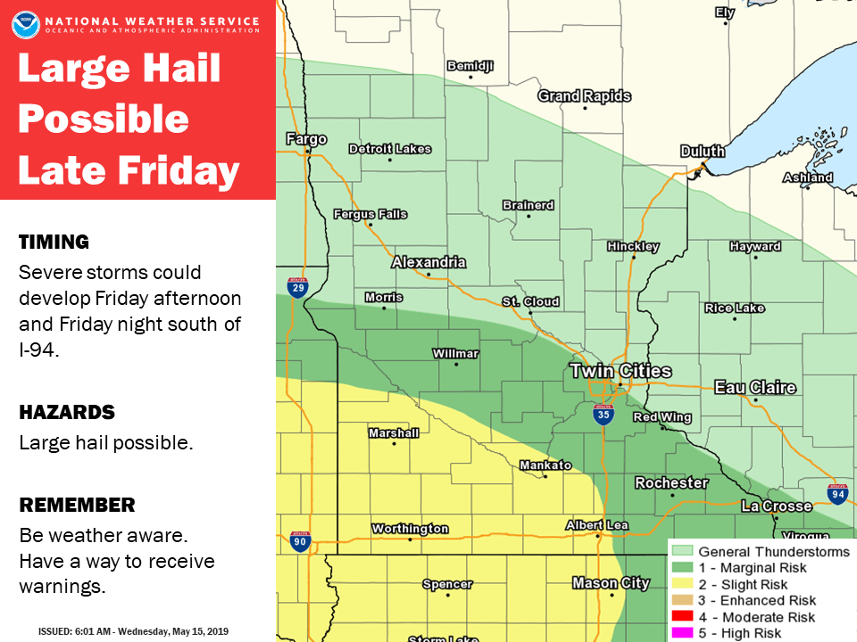
Severe risk late Friday
Friday afternoon and evening could feature some strong to severe storms across southern Minnesota. The risk for damaging winds, hail, and an isolated tornado is there.
Gnarly, wet weekend
The timing for rain this weekend is bad.
Waves of rain, wind, and thunder visit Friday night through Sunday. The latest model runs suggest highs may not climb out of the 50s Saturday with wind and rain. NOAA's GFS model pick up the trend.

Several inches of rain still look likely this weekend.

Temperatures moderate again late next week.

What a "spring."