May snow tapers up north; milder weekend temps
This says a lot:
There was also a snow report of 9.5 inches 7 miles north-northwest of Two Harbors, Minn.
The snow tapers off Thursday morning. You can check snow accumulations as they are posted by the National Weather Service. Hover over a location on their snow map site to see the snow total and the time of observation.
Winter storm warnings and winter weather advisories continue until 10 a.m. this Thursday over much of northeastern Minnesota and parts of northwestern Wisconsin:
Create a More Connected Minnesota
MPR News is your trusted resource for the news you need. With your support, MPR News brings accessible, courageous journalism and authentic conversation to everyone - free of paywalls and barriers. Your gift makes a difference.

Here are the details:
URGENT - WINTER WEATHER MESSAGE
National Weather Service Duluth MN
406 AM CDT Thu May 9 2019
...SNOW TO TRANSITION TO RAIN THEN GRADUALLY DIMINISH...
.Widespread snow and areas of light rain continued across much of
the Northland this morning. The snow will transition to light rain
through the morning then the precipitation will gradually
diminish from west to east. An additional 1 to 3 inches of snow is
expected through 10 AM. Gusty north to northeast winds will
continue today and be strongest this morning around Lake Superior.
MNZ012-020-021-037-WIZ001-002-091500-
/O.CON.KDLH.WS.W.0010.000000T0000Z-190509T1500Z/
Northern Cook and Lake-Southern Lake-Southern Cook-
Carlton and South St. Louis-Douglas-Bayfield-
Including the cities of Isabella, Two Harbors, Silver Bay,
Grand Marais, Duluth, Superior, Washburn, and Bayfield
406 AM CDT Thu May 9 2019
...WINTER STORM WARNING REMAINS IN EFFECT UNTIL 10 AM CDT THIS
MORNING...
* WHAT...Snow. Additional snow accumulations of one to around three
inches. Higher amounts most likely in the tip of the Arrowhead.
* WHERE...In Wisconsin, Douglas and Bayfield Counties. In
Minnesota, Carlton and South St. Louis, Northern Cook and
Lake, Southern Cook and Southern Lake Counties.
* WHEN...Until 10 AM CDT this morning.
* ADDITIONAL DETAILS...Plan on slippery road conditions. The
hazardous conditions could impact the morning commute.
PRECAUTIONARY/PREPAREDNESS ACTIONS...
A Winter Storm Warning for snow means severe winter weather
conditions will make travel very hazardous or impossible. If you
must travel, keep an extra flashlight, food and water in your
vehicle in case of an emergency.
The latest road conditions for Minnesota can be found at
511mn.org, and for Wisconsin at 511wi.gov, or by calling 511 in
either state.
You can check for forecast updates from the National Weather Service office in Duluth.
Updated road conditions will be posted by the Minnesota and Wisconsin transportation departments.
As always, updated weather information can be heard on Minnesota Public Radio, and you’ll also see updated weather info on the MPR News live weather blog.
The Twin Cities metro area will see some light rain showers, possibly mixed with a few flakes, Thursday morning, followed by dry weather most of the afternoon. An isolated sprinkle could develop late in the afternoon. It'll be a breezy day.
Highs will be way below normal across Minnesota and Wisconsin:

The Twin Cities metro area will see highs in the 60s this weekend.
The National Oceanic and Atmospheric Administration’s North American Mesoscale Forecast System model shows the potential precipitation pattern Thursday:
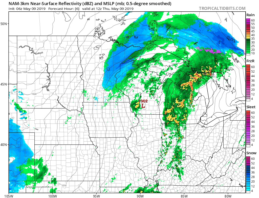
The color chart to the right of the loop refers to the strength of the signal that returns to the radar, not to the amount of snow or rain.
Check back midmorning for an update.
Programming note
You can hear my live weather updates on Minnesota Public Radio at 7:49 a.m. Thursdays and Fridays, and at 7:35 a.m., 9:35 a.m. and 4:35 p.m. each Saturday and Sunday.