5th biggest April snowstorm; 50s and 60s ahead next week
Well, that was interesting.
Our latest bout of April meteorological mayhem dumped as much as 20 inches of snow at Madison in western Minnesota. More than 2 feet fell in South Dakota.
Snowfall reports are still trickling in. I've seen reports around the Twin Cities as low as 6.2 inches in Robbinsdale, to a hefty 13.6 inches in Richfield. Convectively-driven localized snow bursts probably accounted for local differences.
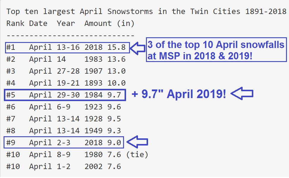
5th biggest April snowfall on record
Create a More Connected Minnesota
MPR News is your trusted resource for the news you need. With your support, MPR News brings accessible, courageous journalism and authentic conversation to everyone - free of paywalls and barriers. Your gift makes a difference.
The Twin Cities National Weather Service reports 9.7 inches at Minneapolis-St. Paul International Airport as of 1 p.m. Friday. That ties for the fifth biggest April snowfall on record. Three of the top 10 April snowfalls on record at the airport have occurred since last April 1!
Storm eases out
The swirling low-pressure center eases out of Minnesota Friday night. A few more hours of snow and drizzle will fall in many Minnesota communities. National Oceanic and Atmospheric Administration's North American Mesoscale Forecast System 3 km resolution model picks up on the last waves of snow and drizzle as high pressure builds in Saturday.

Soaker
This week's storm dumped another 1 to 3 inches of liquid precipitation equivalent on the Upper Midwest. Much of that fell as snow. It will run off into area rivers in the coming week.
The melt is on
It's amazing how fast the snow has begun to melt today. The sun today is as high in the sky as late August. That solar energy is getting through.
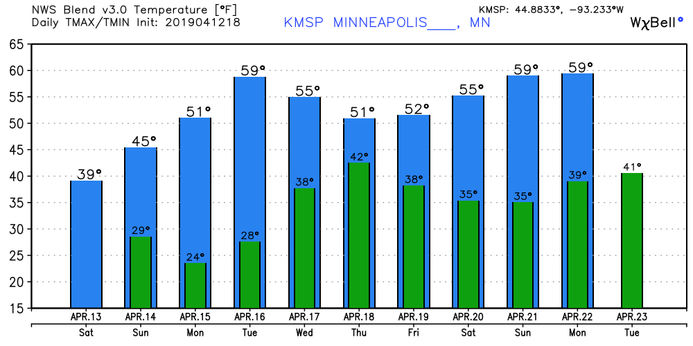
A milder air mass gradually blows in next week. Highs in the 50s are a lock next week. We have a shot at 60 Tuesday, and again next weekend.
C'mon spring!