Rain arrives; fog advisory; flood watch kicks in
The first waves of rain soaked southern Minnesota Tuesday. The main low-pressure wave rides northeast Wednesday.
This system is moisture rich. It carries moisture from the tropical Pacific and will tap into the Gulf of Mexico moisture as it moves northeast. The main low-pressure system is impressive on the GOES-16 satellite spinning as it spins through the southern Rockies. See the center over the northern Gulf of California?

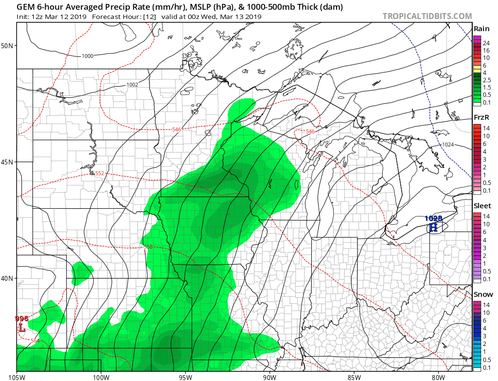
Here's the Canadian model's evolution of the system as it moves into the Upper Midwest Wednesday and Thursday.
Fog First
Create a More Connected Minnesota
MPR News is your trusted resource for the news you need. With your support, MPR News brings accessible, courageous journalism and authentic conversation to everyone - free of paywalls and barriers. Your gift makes a difference.
The moisture-laden air mass will crank up some thick fog overnight. Dense fog advisories are up.
Including the cities of Alexandria, Long Prairie, Little Falls,
Princeton, Mora, Morris, Glenwood, St Cloud, Foley, Elk River,
Cambridge, Center City, Madison, Benson, Montevideo, Willmar,
Litchfield, Monticello, Minneapolis, Blaine, St Paul, Stillwater,
Granite Falls, Olivia, Hutchinson, Gaylord, Chaska, Shakopee,
Hastings, Redwood Falls, New Ulm, St Peter, Le Sueur, Faribault,
Red Wing, St James, Mankato, Waseca, Owatonna, Fairmont,
Blue Earth, and Albert Lea
543 PM CDT Tue Mar 12 2019
...DENSE FOG ADVISORY IN EFFECT FROM 10 PM THIS EVENING TO 1 PM
CDT WEDNESDAY...
The National Weather Service in Twin Cities/Chanhassen has issued
a Dense Fog Advisory, which is in effect from 10 PM this evening
to 1 PM CDT Wednesday.
* VISIBILITY...One quarter mile or less.
* IMPACTS...Significantly reduced visibilities. In addition, icy
patches are possible on untreated paved surfaces where
temperatures fall below freezing overnight over west central
Minnesota.
Flood Watch Kicks-In
The flood watch covers a huge area. It kicks into effect Wednesday into Thursday as the main waves of rain arrive.

Flood Watch
National Weather Service Twin Cities/Chanhassen MN
308 PM CDT Tue Mar 12 2019
...RAIN AND SNOW MELT COULD LEAD TO STREET FLOODING AND PONDING
OF WATER IN LOW LYING AREAS WEDNESDAY AND THURSDAY...
.Temperatures will warm into the 40s Wednesday and Thursday, with
around an inch to an inch and a half of rain expected Wednesday
into Thursday. The heaviest rain will fall Wednesday afternoon
into Wednesday evening. This could lead to street flooding and
standing water across low lying areas. Significant rises on the
main stem rivers are not expected Wednesday or Thursday.
Many of the the drainage systems are full of ice and snow, so any
melting or runoff from the rain could lead to ponding of water in
low lying areas. Temperatures will fall below freezing Friday, so
any standing water will become ice.
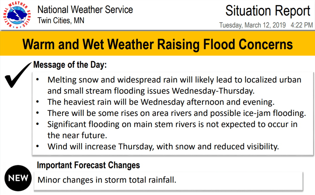
The Twin Cities NWS issues situation reports for major weather events like this one. Here's the overview.
River floods ahead
Phase 1 of the flood threat this week involves localized street flooding based on rainfall and snowmelt. It takes time for all that runoff to work into the bigger river systems. Look for the river flood threat to grow next week. You can keep tabs on the level and forecasts for your local river here.

Here's a closer look at the Red River Valley flood outlook.

Winter Storm Northwest
It's snow across northwest Minnesota and parts of the Red River Valley.

Blizzard Conditions
Deeper into the colder air this looks like an epic Dakotas blizzard. Blizzard warnings are flying.

Including the cities of Carrington, Jamestown, Napoleon, Gackle,
Lamoure, Edgeley, Kulm, Wishek, Ashley, Oakes, and Ellendale
306 PM CDT Tue Mar 12 2019
...BLIZZARD WARNING IN EFFECT FROM 6 PM WEDNESDAY TO 7 PM CDT
THURSDAY...
* WHAT...Blizzard conditions expected. Total snow accumulations of
10 to 15 inches expected with isolated higher amounts possible.
Winds gusting as high as 65 mph.
* WHERE...Portions of south central and southeast North Dakota,
including the cities of Jamestown, Napoleon, and Ellendale.
* WHEN...From 6 PM Wednesday to 7 PM CDT Thursday.
* ADDITIONAL DETAILS...Travel will be very difficult to
impossible. Widespread blowing snow will significantly reduce
visibility. Very strong winds may cause downed powerlines.
Spring: Here to stay in the Twin Cities?
It looks more spring than winter over the next two weeks. I'm not hearing many complaints.
