Very slippery Monday morning with much colder temperatures arriving

Monday morning's urgent headline for many of us:
Watch Your Step
Freezing drizzle, freezing rain and refreeze of snow that melted on Sunday have caused very icy conditions across many parts of Minnesota early on Monday as temperatures slipped below freezing.
One of the hardest-hit areas has been the Twin Cities metro area where highways, streets and sidewalks have become dangerously icy as temperatures fell into the 20s well before sunrise.
Create a More Connected Minnesota
MPR News is your trusted resource for the news you need. With your support, MPR News brings accessible, courageous journalism and authentic conversation to everyone - free of paywalls and barriers. Your gift makes a difference.
This is all happening courtesy of a strong cold front from the northwest.
As of 6 a.m. on Monday temperatures across Minnesota ranged from 36 in Winona in the southeast corner to 2 below zero in Moorhead, Crookston, Wheaton and Ortonville to the west and northwest.
Gusty northwest winds will bring falling temperatures southeastward across the state. Expect temperatures in the Twin Cities area to drop to the low teens by late Monday afternoon.
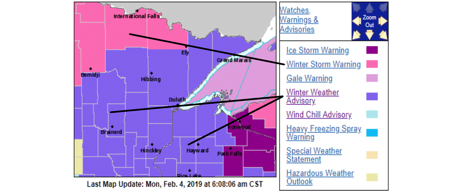
Winter warnings and advisories
Meanwhile, several inches of snow has been accumulating across northern Minnesota. Winter storm warnings continue until noon on Monday for northwestern Minnesota and until 3 p.m. for parts of north central Minnesota.
Winter weather advisories for freezing drizzle and mixed precipitation will continue during the morning with various expiration times.
More wind chill
Gusty winds and falling temperatures have led to a wind chill advisory for parts of western Minnesota into Tuesday morning.

Unsettled week
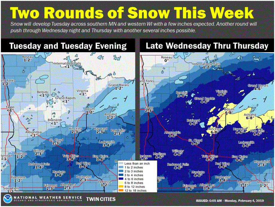
The atmosphere is going to be jittery this week. A fairly weak disturbance will spread a bit of snow across mainly the southern half of Minnesota on Tuesday. The Twin Cities area might pick up 2 or 3 inches of fresh snow.
Expect high temperatures on Tuesday in the single digits in the north and teens in the south.
A stronger weather system will slide slowly across our area from Wednesday afternoon through Thursday. Snowfall likely will be rather light, but the prolonged event could allow several inches to accumulate over much of the state.
Colder temperatures again later this week
Chilly Canadian high pressure should be centered over Saskatchewan by Wednesday and track our way for colder-than-normal conditions for Thursday, Friday and Saturday.

High temperatures on Friday could be just in the single digits below zero across much of Minnesota and positive singles near the southern and eastern edges. That will be cold, but fortunately not a rerun of last week's severe arctic outbreak.