Snow blitz: 5 to 10 inches likely by evening
It's here.
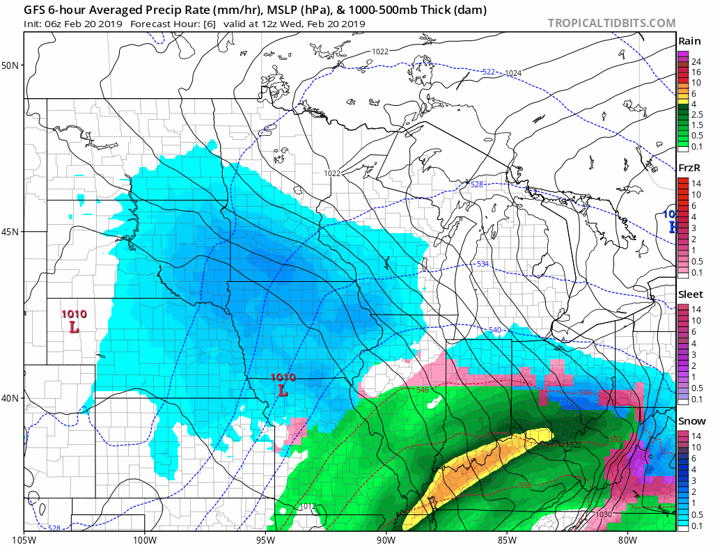
Our latest winter storm pastes most of Minnesota with heavy snow Wednesday. Snowfall rates are reaching 1 to 2 inches per hour at times. Winter storm warnings are up for most of the state.
Prolific snow producer
This system is primed to produce heavy snowfall totals Wednesday.
Create a More Connected Minnesota
MPR News is your trusted resource for the news you need. With your support, MPR News brings accessible, courageous journalism and authentic conversation to everyone - free of paywalls and barriers. Your gift makes a difference.
The heaviest bursts of snow in the Twin Cities favor the morning and midday hours. Intensity may dial back a bit in the afternoon. Snow will end from south to north Wednesday evening.
Here's the National Oceanic and Atmospheric Administration's Global Forecast System model showing the progression of snow.
5- to 10-inch totals
I'm already seeing snowfall totals over 5 inches in southwest Minnesota. This is dry snow with snow to water ratios around 16:1. That means high-quality stellar dendrites that can pile up quickly.
I think we'll see widespread 5- to 10-inch totals from the North Shore through central and southern Minnesota by Wednesday night.

Bottom Line: Expect snowfall into the evening hours. Both rush hours will be slick. Most of us will see 5- to 10-inch snowfall totals by Wednesday night.
Milder temperatures
At least temperatures will be milder as we head toward the weekend. Colder air invades again next week. I know.

Weekend storm still on track
We logged 22.6 inches snow at Minneapolis-St. Paul International Airport in February before Wednesday's storm. Thirty inches this month looks like a lock. That would be the snowiest February on record, and one of the top 10 snowiest months ever recorded at MSP.
The weekend system still looks likely to produce several more inches of snow. Track specifics still to be determined. A lead wave Friday brings a shot of snow.

The main low-pressure system arrives Saturday into Sunday.

Stay safe out there, and stay tuned.