Cold sunshine today; snow for parts of Minnesota this weekend
Thursday’s snow total at Minneapolis-St. Paul International Airport was 5.9 inches, which brings our official February total to 10.4 inches:

The "R" after the 5.9 inch entry means that a new Twin Cities snowfall record was set for February 7.
Disregard the snow depth, that measurement was taken early Thursday morning.
MSP airport tallied more snow during the first week of February than during the entire month of January. The December and November monthly snowfall totals at MSP airport were both lower than our current February total.
Create a More Connected Minnesota
MPR News is your trusted resource for the news you need. With your support, MPR News brings accessible, courageous journalism and authentic conversation to everyone - free of paywalls and barriers. Your gift makes a difference.
You can check snow accumulations as they are posted by the National Weather Service. Hover over a location on the NWS snow map to see the snow total and the time of observation.
The National Weather Service also compiled a county by county list of snowfall reports from Thursday. Hit the "previous version" link at the top of that page to get to Thursday evening.
Cold and colder
Friday afternoon high temps will stay below zero across most of Minnesota. Some locations in the Twin Cities metro area will probably touch zero.
Wind chill advisories expire at noon today in the metro area. Wind chill warnings in western Minnesota are scheduled to become wind chill advisories for Friday afternoon through Saturday morning.
As always, updated weather information can be heard on the Minnesota Public Radio Network, and you’ll also see updated weather info on the MPR News live weather blog.
Low temps late Friday night/early Saturday morning will be in the 20s below zero in northern and central Minnesota with teens below zero in the south:
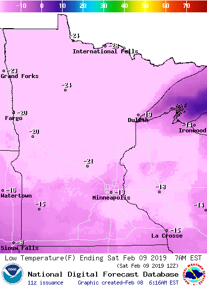
I wouldn't be surprised if some spots in northern Minnesota drop to minus 30 or colder early Saturday morning.
Saturday highs reach double-digits above zero in the metro area and southern Minnesota:

Sunday highs are a few degrees milder:

Metro area highs are expected to reach the lower 20s Monday and Tuesday, then they retreat back into the teens for Wednesday and Thursday.
Snow chances
Northern and central Minnesota could see a few occasional snow showers on Saturday.
Much of southern and central Minnesota will probably see some snow on Sunday.
The National Oceanic and Atmospheric Administration’s North American Mesoscale forecast model shows the potential snow pattern Saturday morning through Sunday afternoon:

Southern Minnesota could see enough snow to shovel on Sunday, check updates for snow amounts.
Plowable snow?
NOAA's Global Forecast System model shows the potential for a plowable snow Monday night and Tuesday:
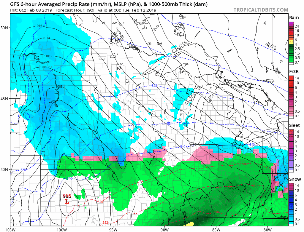
The color chart to the right of the loop refers to the precipitation rate (mm per hour), not to the total amount of snow or rain.
Check forecast updates if you have travel plans during that time frame.
Programming note
You can hear my live weather updates on Minnesota Public Radio at 7:49 a.m. Thursdays and Fridays, and at 7:35 a.m., 9:35 a.m. and 4:35 p.m. each Saturday and Sunday.