Coldest air in 23 years? Snow, then a shot at -25F at MSP
Buckle up for what looks like the most challenging week of winter ahead for Minnesota.
This weekend's cold will pale in comparison to next week's bitter arctic outbreak. Next week likely brings the coldest air this winter. And we open the week's festivities with a shot of significant snow Sunday and Monday.
Here's a rundown on the latest take on our inbound snow and bitter cold.
Headlines
Create a More Connected Minnesota
MPR News is your trusted resource for the news you need. With your support, MPR News brings accessible, courageous journalism and authentic conversation to everyone - free of paywalls and barriers. Your gift makes a difference.
The low was -9 at MSP Airport Friday. That's the coldest so far this winter.
Cold wave #1 continues with sub-zero lows this weekend.
Sunday/Monday snow system tracking slightly north. That could boost MSP snowfall totals.
Coldest air in 23 years possible next week in the Twin Cities.
Sunday snow system
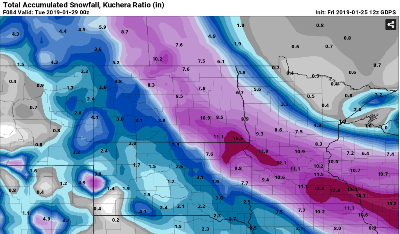
The latest American and Canadian model trends favor a more northward track on our late weekend snow system. That would bring heavier snowfall total into the greater Twin Cities area Sunday afternoon through Monday.
Here's NOAA's GFS model.

The latest model trends suggest that 4 to 8+ inches of snow is looking more possible for the Twin Cities. The heaviest bands of 6 to 12-inches plus should lay out along the Minnesota River Valley but could include the southwest Twin Cities in this scenario. Snow to water ratios should be higher than 15:1 so the powdery snow will pile up efficiently. Skiiers will love that.
This Canadian model snowfall output may, or may not be overdone. But it gives you an idea of the closer proximity of the heaviest snow band to the Twin Cities.
Polar Vortex: -20s next week?
Ask a Minnesota climate expert and they will tell you climate change has made it harder to reach -20 in the Twin Cities. But next week's inbound arctic air mass seems to have the street cred to get it done. All forecast models right now are cranking out lows in the 20s below zero next Wednesday and or Thursday morning. Some go as low as -30 at MSP. 30-below is going to be a tough task but I can't rule it out.

Coldest in 23 years?
The record lows next Wednesday and Thursday are -30 and -27 degrees at MSP Airport. If we get to -24 at MSP it will be the coldest day in about 23 years since MSP hit -32 on February 2, 1996.

Some longer range models suggest 30s above zero by Super Bowl weekend.
Stay tuned and stay warm!