20s again on Sunday; snowstorm for North Carolina and Virginia
We had enough snow to shovel and plow in the Twin Cities and southern Minnesota last weekend.
This weekend, the biggest snow totals are forecast for North Carolina and Virginia.
The National Oceanic and Atmospheric Administration's North American Mesoscale forecast model shows the potential precipitation pattern from Saturday evening through Sunday evening:

The blue areas in the loop indicate snow.
Create a More Connected Minnesota
MPR News is your trusted resource for the news you need. With your support, MPR News brings accessible, courageous journalism and authentic conversation to everyone - free of paywalls and barriers. Your gift makes a difference.
The color chart to the right of the loop refers to the strength of the signal that returns to the radar, not to the amount of snow or rain.
Double-digit snowfall totals are expected in parts of northwestern North Carolina this weekend, and some locations will see freezing rain:
Some areas in southwestern Virginia could also see double digit totals.
Here's a summary of Virginia and northwestern North Carolina warnings and potential snow amounts this weekend:

Virginia's governor declared a state of emergency due to the ice and snow that will hit the southern portion of Virginia this weekend:
North Carolina's governor has also declared a state of emergency due to their weekend winter storm.
Quiet in Minnesota
There aren't any big winter storms in our Minnesota forecast this weekend.
We could see some patchy areas of freezing fog in central and southern Minnesota and west-central Wisconsin late Saturday night and early Sunday morning.
As always, updated weather information can be heard on the Minnesota Public Radio Network, and you will also see updated weather info on the MPR News live weather blog.
There's a chance of snow showers in Minnesota and western Wisconsin Thursday and Thursday night.
NOAA's Global Forecast System model shows the potential precipitation pattern Thursday and Thursday night:
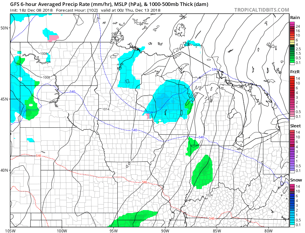
The color chart to the right of the loop refers to the precipitation rate (mm per hour), not to the total amount of rain or snow.
Temperature trends
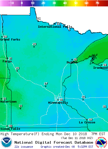
Minnesota highs are expected be in the 20s Sunday afternoon.
Similar highs are on tap for Monday, but the southwest might pop into the lower 30s:
Twin Cities metro area highs will reach about 30 degrees on Tuesday, followed by lower 30s Wednesday, Thursday and Friday.
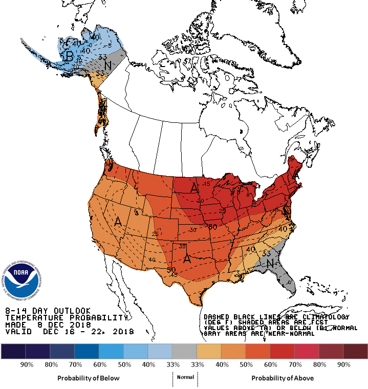
The NWS Climate Prediction Center shows a tendency for warmer than normal temps over Minnesota and Wisconsin the Dec. 16 through Dec. 22 time period:
Programming note
You can hear my live weather updates on Minnesota Public Radio at 7:49 a.m. Thursdays and Fridays, and at 7:35 a.m., 9:35 a.m. and 4:35 p.m. each Saturday and Sunday.