Snowy rumors next week?
It's that time of year in Minnesota.
The weather maps require precise inspection on a daily basis. Weather systems spin-up and drive toward Minnesota in late fall. Temperature profiles in the lower atmosphere become critical, hovering a few degrees either side of freezing. The difference between a cold rain, and a pile of early November snow on your driveway? One or two degrees.
I'm still watching some model solutions that spin up a possible wintry storm for parts of Minnesota late next week. More details in on that the blog below. Our welcome weather winning streak of sunny dry days is on pause for now.

Blue to gray
Create a More Connected Minnesota
MPR News is your trusted resource for the news you need. With your support, MPR News brings accessible, courageous journalism and authentic conversation to everyone - free of paywalls and barriers. Your gift makes a difference.
It's been a well-earned sunny stretch. Our string of sunny, tranquil days is good tonic for the Minnesota's collective weather soul. Our next weather system slides in slowly. We trade blue skies for grey. Occasional rain lingers through Friday. Saturday looks like the drier day of the weekend. A follow-on system brings more showers Sunday.
Here's NOAA's GFS model version of weather events through this weekend.

Gradually cooler
Our temperatures trend gradually downward over the next week. No big cold front lurk, but temperatures approach the critical freezing point as we hit November next Thursday.
November.
How did that happen anyway?

Snow chance lurks next week
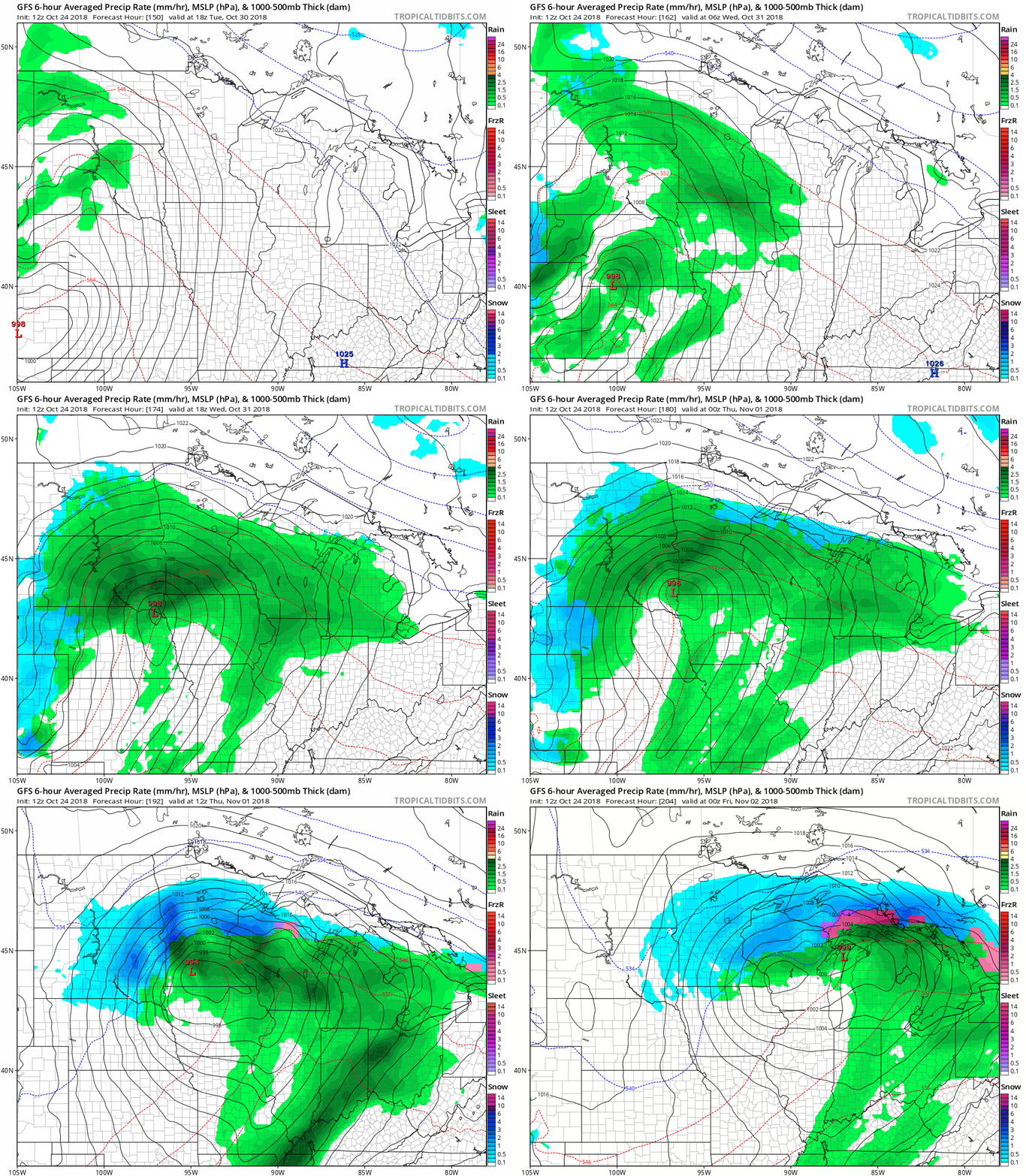
I'm still creeping on the weather maps for next week. The GFS and European models still suggest a potentially wet Halloween. But NOAA's GFS is still taking it a snowy step further for much of central Minnesota next Thursday. It's just one model a week out so take it with a big shaker of salt. But the GFS spins up a potential snowmaker for central Minnesota and possibly the Twin Cities as we open November.

A rainy Halloween followed by a snowy start to November? I know.
Stay tuned.