Winter storm: worst conditions late tonight and Saturday
Here's a quick update on our inbound winter storm. remember for the latest up to the minute live updates check out the MPR Live Weather blog.
Slow start
There's an old saying in the weather business: "Never rush a good snowstorm."
We'll see a patchy mix of rain, wet snowflakes and a possible icy mix into early evening. Travel should still be fairly good through the afternoon hours. Precipitation trends toward all snow Friday night and Saturday. Expect the heaviest snowfall Saturday, probably in the afternoon.
Create a More Connected Minnesota
MPR News is your trusted resource for the news you need. With your support, MPR News brings accessible, courageous journalism and authentic conversation to everyone - free of paywalls and barriers. Your gift makes a difference.
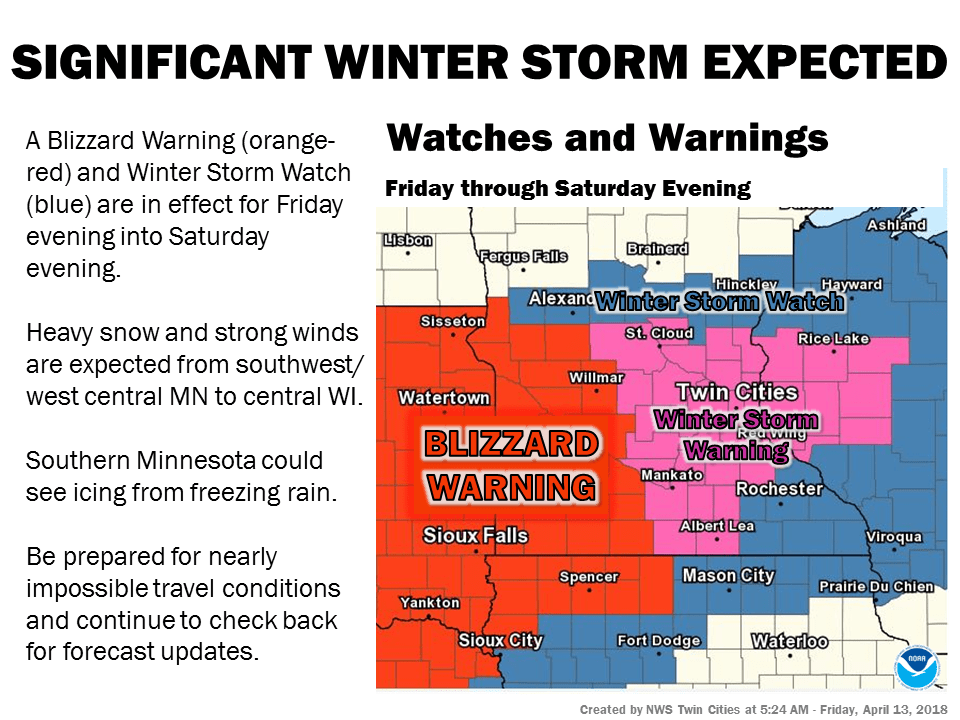
Some updated storm points.
Blizzard warnings still up for southwest Minnesota.
Winter storm warnings for the Twin Cities.
Latest satellite/radar/model trends show a slower onset of storm conditions.
Expect patchy rain/snow areas today, travel should be fairly good through the PM hours.
Rainy mix will change to all snow Friday night. Heaviest snow will actually fall Saturday, probably in the afternoon.
I am still staying conservative on snowfall forecasts. Models are going gangbusters but I see some limiting factors.
Still expecting widespread 6” to 12” snowfall totals including the Twin Cities.
There could be some local 15”+ totals by Sunday night, especially SW of MSP.
Winds of 30 to 50 mph will cause blowing and drifting this weekend.
The Canadian model shifts the heaviest snow zone south of the Twin Cities across southern Minnesota.

Here's the going National Weather Service forecast map.

Stay tuned!