Wednesday clipper trending south; significant warming trend ahead
Today is a battle of opposing weather elements.
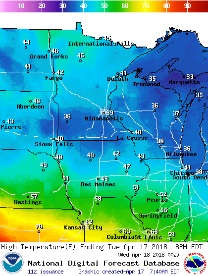
A deep slushy snow cover clings to the ground against a bright mid-April sun. Today's sun angle and intensity is equal to late August. That should drive temperatures into the low 40s across much of Minnesota today. Instant puddles and new small lakes fill the streets as snow-pack withers under a heat lamp sun.
Wednesday clipper
Our next, and potentially last snowy clipper dives into southern Minnesota Wednesday. The latest model trends suggest a more southerly track. And that could spare parts of the Twin Cities any significant snow accumulations. The best chance for a couple inches of slush favors the south metro.
Create a More Connected Minnesota
MPR News is your trusted resource for the news you need. With your support, MPR News brings accessible, courageous journalism and authentic conversation to everyone - free of paywalls and barriers. Your gift makes a difference.
The National Oceanic and Atmospheric Administration's North American Mesoscale Forecast System 3 km resolution model captures the notion of accumulating snow in southern Minnesota, with the northern edge of the snow shield just grazing the Twin Cities.

Winter storm warnings are up for the I-90 and southern I-35 corridors. Winter weather advisories include the southern tier for Twin Cities counties.

URGENT - WINTER WEATHER MESSAGE
National Weather Service Twin Cities/Chanhassen MN
318 AM CDT Tue Apr 17 2018
...ACCUMULATING SNOW LIKELY FOR SOUTHERN MINNESOTA TUESDAY NIGHT
THROUGH WEDNESDAY EVENING...
.A low pressure system coming out of the Central Plains today will
shift across Iowa Wednesday and into the Great Lakes Wednesday
night. Mainly light to moderate snow is expected, though some
pockets of heavy snow will be possible around the Interstate 90
corridor along with isolated thunderstorms. Much of southern
Minnesota can expect accumulating snow out of this system, with
the heaviest snow along and south of a line from Saint James to
Owatonna where between 5 and 8 inches of snow can be expected.
A Winter Storm Warning has been issued for Martin, Faribault,
Freeborn, Waseca and Steele counties in southern Minnesota where 5
to 8 inches of snow can be expected. North of the warning, a
Winter Weather Advisory has been issued for areas along and south
of a line from Madison to Olivia to Biscay to Chaska to Apple
Valley to Red Wing
Twin Cities rides the edge
Several inches of snow is likely in southern Minnesota Wednesday. The Twin Cities rides the northern edge of the accumulation zone. The latest model trends suggest to me a slight southward shift, and that snowfall totals in the metro core may be very light. Travel will increasingly difficult as you move south of the Twin Cities.

Warmer days ahead
How about some good weather news? All forecast models suggest a significant northward shift in the jet stream in the next week.

Temperatures begin to moderate as soon as late this week. Highs in the 50s look likely by this weekend.

Both the European and American models are still cranking out highs in the 60s next week. NOAA's Global Forecast System continues to push highs toward the 70 degree mark by the last weekend in April.

Stay tuned!