Impressive systems: A foot of snow by Sunday?
It's all systems go for our next snow event Thursday.
All major forecast models agree it will snow across most of Minnesota Thursday and Thursday night. There are a few differences in timing and totals, but the impact is basically the same. It's going to get slick out there again.
The system
Thursday's inbound low-pressure system hails from Colorado by way of Nebraska. Snowfall breaks out Thursday morning in southern Minnesota along the Interstate 90 corridor and spreads northeast across Minnesota and northern Wisconsin. The heaviest bands of snow arrive Thursday night.
Create a More Connected Minnesota
MPR News is your trusted resource for the news you need. With your support, MPR News brings accessible, courageous journalism and authentic conversation to everyone - free of paywalls and barriers. Your gift makes a difference.
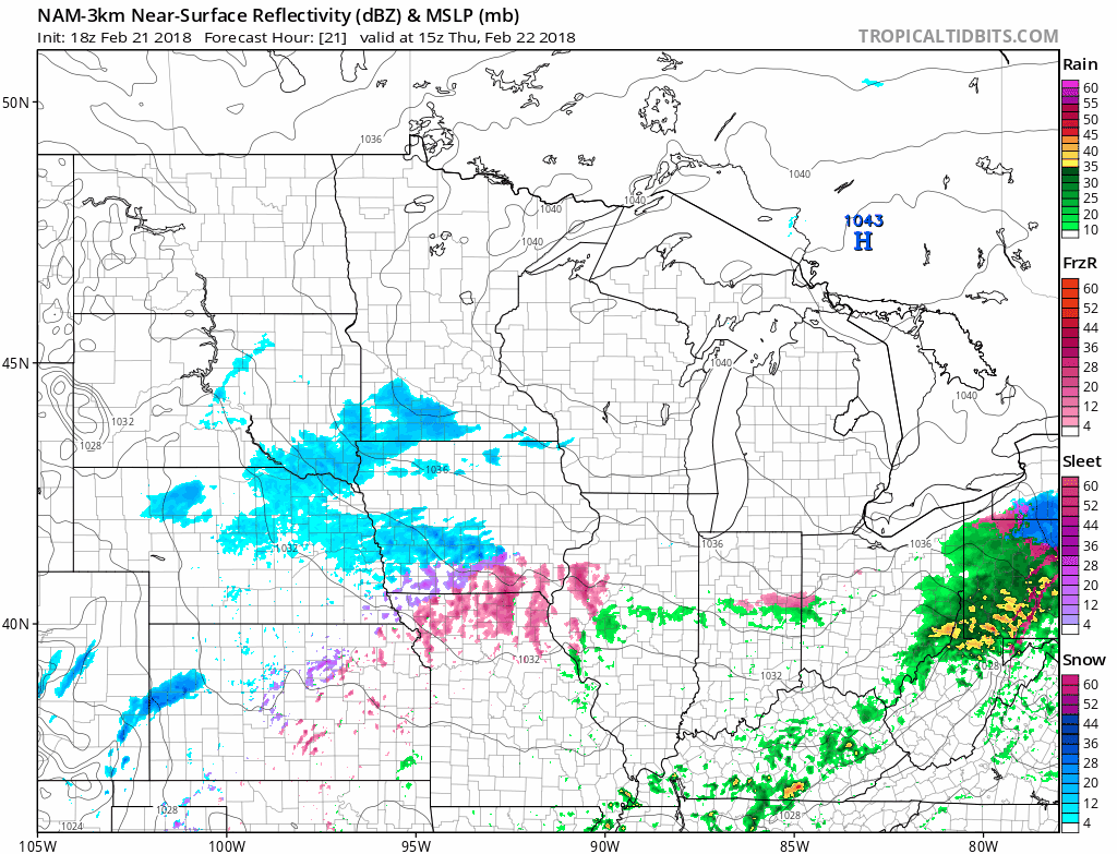
Snowfall timing
There are still significant model differences in timing for onset of snow in the Twin Cities. The National Oceanic and Atmospheric Administration's North American Mesoscale Forecast System model suggests 1 p.m, while NOAA's Global Forecast System suggests around 3 p.m. The European Centre for Medium-Range Weather Forecasts brings snow into the Twin Cities closer to 4 p.m.
Either way, snow gets going in southern Minnesota Thursday morning and spreads northeast during the day. Afternoon rush hour will likely be impacted in the Twin Cities as snow gets going.
Snowfall totals
I'm impressed with the physical dynamics of what at first looked like a run-of-the-mill system. The upglide over departing cold air can be an efficient snow producer. I think widespread snowfall totals of 2 to 5 inches look likely across Minnesota by Friday morning. I think some local 6-inch totals are possible from the Twin Cities to Duluth.

Icing potential again
Southeast Minnesota is the favored zone for icing once again with this system.
Bottom line: Snow spreads form southwest to northeast across Minnesota Thursday. Snow begins in the Twin Cities Thursday afternoon. Heaviest snow in the Twin Cities falls between about 8 p.m. and 3 a.m. Friday.
Widespread totals between 2 and 5 inches are likely. Some local 6 inches-plus totals are possible. Roads will be challenging again Thursday night into Friday morning rush hour.
Next storm Saturday?
Saturday's low-pressure system looks even more impressive.
This one looks like a classic Panhandle Hook storm capable of dumping 5 to 10 inches of heavy wet snow. NOAA's GFS shows the system forming at the tip of the Oklahoma Panhandle, then winding up and racing northeast for Minnesota with a snowy payload.

Heavy snow potential
It's still early, but this one has all the earmarks of a heavy, wet snow producer. Confidence is high for a band of heavy snow across Minnesota. Confidence is lower as to precisely where that band will set up. Here's what NOAA's GFS model thinks as of this writing.

A foot of snow by Sunday?
Between Thursday's system and our weekend storm, many spots in Minnesota could pick up a foot of snow by Sunday.

Stay tuned as we update storm tracks and totals over the next few days.