Wintry relapse: Cold rain and snow returns this week
Ah, spring in Minnesota. Two steps forward, one step back.
As I write this it's 70 degrees at the rapidly greening Huttner Weather Lab in the southwest metro.

Meanwhile it's 32 in Grand Marais, and a windy raw 37 degrees at Duluth harbor on the still icy cold water of Lake Superior.

That sharp temperature contrast fuels a dramatic weather mix over Minnesota this week. The next low pressure wave spins north Tuesday into Wednesday. Depending on where you live, you may enjoy light rain, heavy rain, thunder, snow, sleet and ice.
Create a More Connected Minnesota
MPR News is your trusted resource for the news you need. With your support, MPR News brings accessible, courageous journalism and authentic conversation to everyone - free of paywalls and barriers. Your gift makes a difference.
This week's weather reminds us, it's still April in Minnesota.

Massive temperature contrast drives storms
Our atmosphere is constantly searching for balance. That's rarely achieved in Minnesota. Huge temperature contrasts at this latitude spin up powerful storms this time of year.
Our next low pressure system wraps up and charges north Tuesday. Waves of rain hit first. Then snow breaks out on the systems northwest fringes Tuesday night into Wednesday as colder air wraps in.

Another inch of rain south
Our inbound system brings another soaking to most of Minnesota. Another wave of 1" to 2"+ precipitation streaks across Minnesota this week.

Rainfall totals of an inch or more are likely in or near the Twin Cities and in much of central and southern Minnesota.

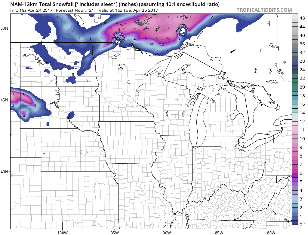
Snow up north
There are still some differences in the precise location of snowy bands in central and northern Minnesota. The common sense approach at this point is to prepare for snow Tuesday night into Wednesday. Potentially plowable snow in some areas.
NOAA's GFS lays down a respectable swath of 4" to 9" totals across north-central Minnesota.

NOAA's NAM 12 km resolution model goes hog wild. A foot to 19" along the North Shore? Probably too aggressive, but worth watching on tomorrow's model runs.
Much colder this week
Our flirtation with May-like 70s is over for a while. Temperatures crash almost 30 degrees this week in the Twin Cities and southern Minnesota. Highs stagger through the 40s Wednesday and Thursday. The weekend looks cool, with highs in the 50s.

Keep the rain gear handy statewide, and the snow shovel handy up north this week.