Frosty nights, rare sun sightings ahead
Minnesota weather is like a trip to Vegas. You can bet on the occasional snow-free April. But the house odds are against you. Get ready for a couple more frosty mornings as we head into the weekend.
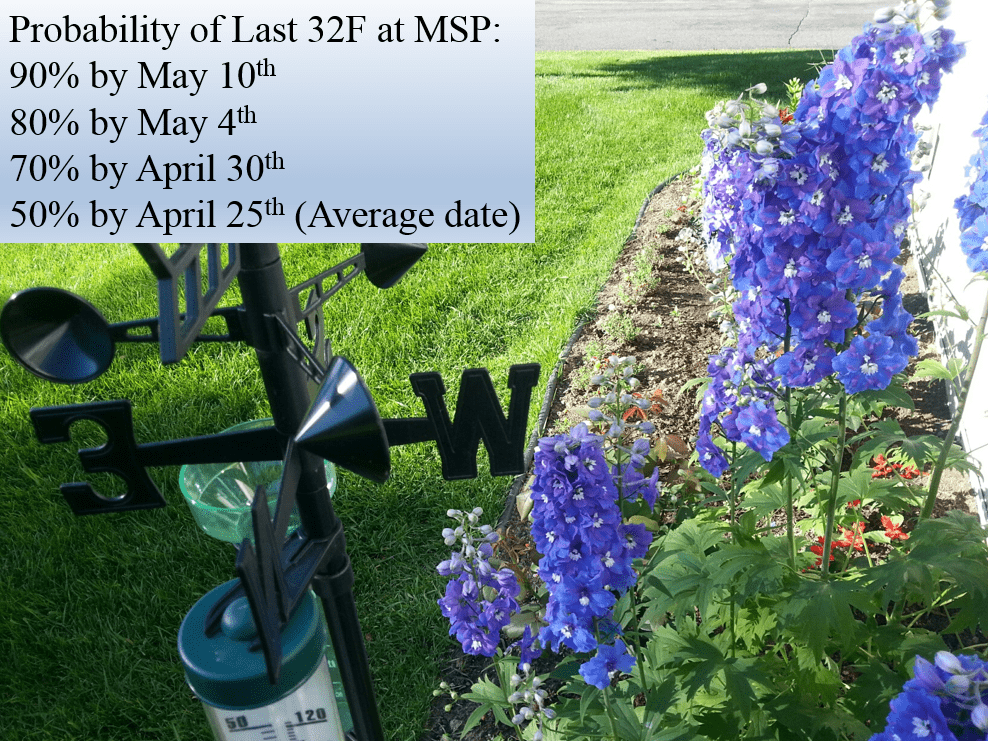
This is why we plant the petunias in May in Minnesota.
Frost typical for this time of year
The average date of the last frost at Minneapolis-St. Paul International Airport over the past 30 years in southern Minnesota ranges from late April into early May. Here's the map from the Midwest Regional Climate Center.
Create a More Connected Minnesota
MPR News is your trusted resource for the news you need. With your support, MPR News brings accessible, courageous journalism and authentic conversation to everyone - free of paywalls and barriers. Your gift makes a difference.
Historically there's a 90 percent chance that the last frost of spring will occur by May 10. Place your bets this year.
Cool pattern continues for now
We enjoy about seven more cool days, then temps recover again by next weekend. I'm ready now.

Sun returns
We'll see at least partial sunshine Friday and Saturday. Look for a mix of clouds, but much more sun than we've seen recently. Any sun will be a bonus, and may disorient Minnesotans at this point. Here's the National Oceanic and Atmospheric Administration's low cloud fraction animation for Friday and Saturday.

Next (slop?) storm arrives Sunday
Remember I'm just the messenger. A chilly rain surges north again Sunday and may mix with and change to snow by Monday morning. The Euro insists precip will be all rain. NOAA's GFS suggest a mix with some light slush Monday. The Canadian model says we'll see several inches of slop on our lawns. Nice to have consensus.
My money usually leans toward the European Centre for Medium-Range Weather Forecasts solution, but this will have to be watched.
Here's NOAA's Global Forecast System version of events, a rain to slop mix.

NOAA's GFS shows slushy accumulations by Monday.

It can snow in May
Anyone remember that early May snowstorm four years ago?
Spring returns next weekend
The longer range models favor a return to milder weather as the jet stream lifts northward for the first weekend of May.

Temps in the 60s should returns by the weekend of May 6-7. Not summer, but reasonable for spring.

At this point we'll take it.
20 in a row
Yes, it's been chilly this week. But April is still running 5 degrees warmer than average at MSP Airport. This still looks like it will go down as our unprecedented 20th straight warmer than average month.