Milder temps Monday; wintry mix south and snow north Monday night
Minnesotans enjoyed some very nice weather on Sunday, with plenty of sun and afternoon temps near seasonal normals.
It'll be warmer on Monday, but we'll have a lot of clouds.
Snow north
Far northern Minnesota will see periods of snow overnight Sunday night into Monday morning.
Create a More Connected Minnesota
MPR News is your trusted resource for the news you need. With your support, MPR News brings accessible, courageous journalism and authentic conversation to everyone - free of paywalls and barriers. Your gift makes a difference.
The National Oceanic and Atmospheric Administration’s North American Mesoscale forecast model shows the projected snowfall pattern over northern Minnesota:
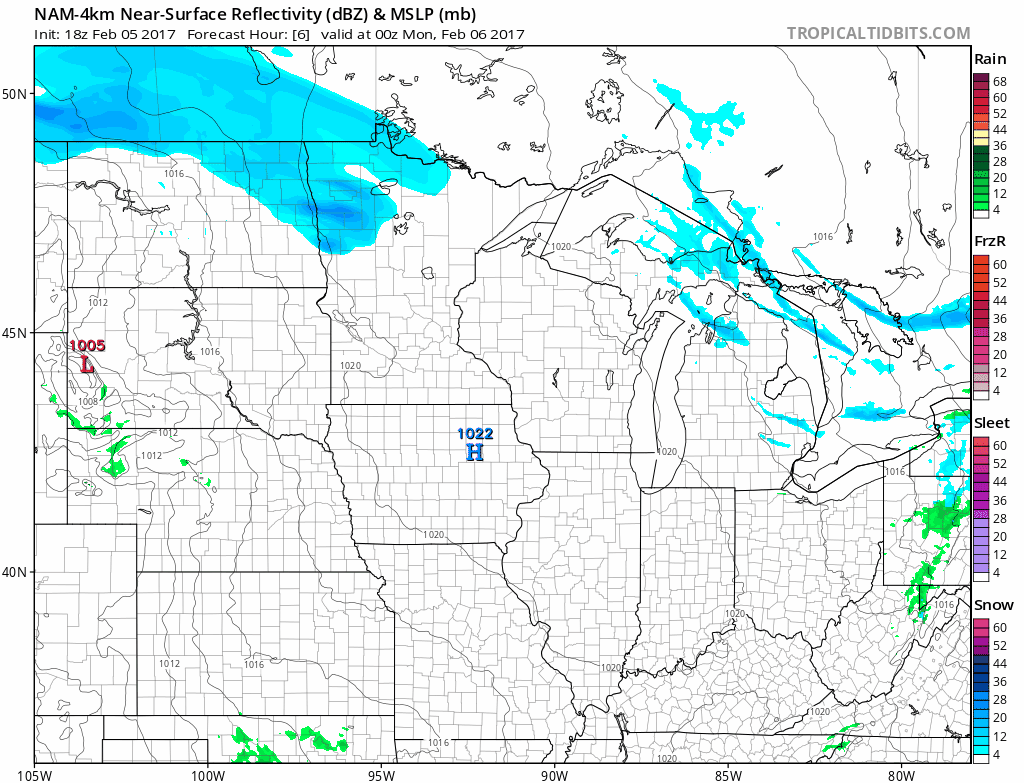
The color chart on the lower right of the loop refers to the strength of the radar signal returning to the radar, not inches of snow!
Areas closest to the Canadian border will see the most snow overnight through Monday morning, as much as 2 to 3 inches.
Monday night and Tuesday
Each run of the forecast models is showing less precipitation (and less snow) for southern Minnesota Monday night and Tuesday.
NOAA's NAM forecast model shows the precipitation pattern Monday evening through Tuesday afternoon:

Again, the color chart on the lower right of the loop refers to the strength of the radar signal returning to the radar, not inches of snow!
Snow is indicated by blue, rain by green, sleet or freezing rain by purple.
If surface temps are cold enough, some green shaded areas could have freezing rain/drizzle.
Much of southern Minnesota is expected to see a wintry mix of light rain/drizzle, light freezing rain/freezing drizzle, sleet and snow Monday night into early Tuesday.
That mix is expected to change to all snow at some point on Tuesday.
Snow amounts Monday night and Tuesday will be highest over northern Minnesota.
Here are some possible amounts:

Far northern Minnesota could see over 4 inches Monday night into Tuesday.
That is in addition to their Sunday night/Monday morning snowfall totals.
Snow amounts are expected to be minimal over most of southern Minnesota and the Twin Cities:

The Twin Cities metro area could see less than one inch of snow Monday night through Tuesday, unless colder air is pulled into the low pressure system.
Milder Monday temps
Southern Minnesota will top out in the 30s Monday, with 20s to the north:

Highs Tuesday morning will be mostly in the 20s, with lower 30s southeast. Falling temps are expected Tuesday afternoon.
Wednesday is the coldest day in the forecast, with highs in the single digits over northern Minnesota and teens over central and southern Minnesota. you
If that's too cold for you, wait until Friday... Twin Cities highs should be in the 40s.
Video of the day
You can see two meso-lows or small circulations within a larger low pressure system off the northwest coast of the United States yesterday.
Nice!