Messy Christmas 2016: Snow, ice, sleet, rain, thunder, flood potential
Minnesota's Weather Santa is in the giving mood this year. Get ready for an active and highly unusual weather pattern this Christmas weekend.
In the next 4 days we'll see snow, ice, sleet, heavy rain, thunder and flood potential across Minnesota.
Christmas thunderstorms in Minnesota. What next, locusts?
Friday snow first
Create a More Connected Minnesota
MPR News is your trusted resource for the news you need. With your support, MPR News brings accessible, courageous journalism and authentic conversation to everyone - free of paywalls and barriers. Your gift makes a difference.
A minor low pressure system slides south of Minnesota Friday. Warm air ahead of the system will likely trigger a band of light snow Friday. It doesn't look heavy, but it may be enough to slick up roads with an inch or so now looking likely during the day Friday. The favored snow zone Friday includes southeast Minnesota, from the Twin Cities south and east through Austin. Rochester and Eau Claire.
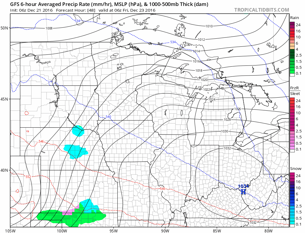
Again the snow looks light and temps may be at or above freezing. Not a huge deal, but worth noting.
Highly unusual Christmas storm
The storm system moving north into Minnesota for Christmas day is exhibiting some highly unusual characteristics for late December. The system is unusually warm, and will likely contain about 1" of what meteorologists call "precipitable water." That amount of moisture in a late December storm is at record levels for Minnesota, and could be a 4 to 5 standard deviations above average.
The Twin Cities NWS elaborates in today's forecast discussion.

1" to 2" liquid precipitation totals
The storm looks likely to dump 1" to 2" liquid precipitation totals across the Upper Midwest. That much liquid precip is highly unusual for winter at this latitude.

Western track: Mostly rain for MSP
The latest model runs continue the trend of a western storm track. That track solution pumps a tremendous amount of warm advection ahead of the low pressure center. A brief period of snow and ice arrives early Christmas Day, then a quick change to all rain for most of eastern Minnesota as the low surges northward.
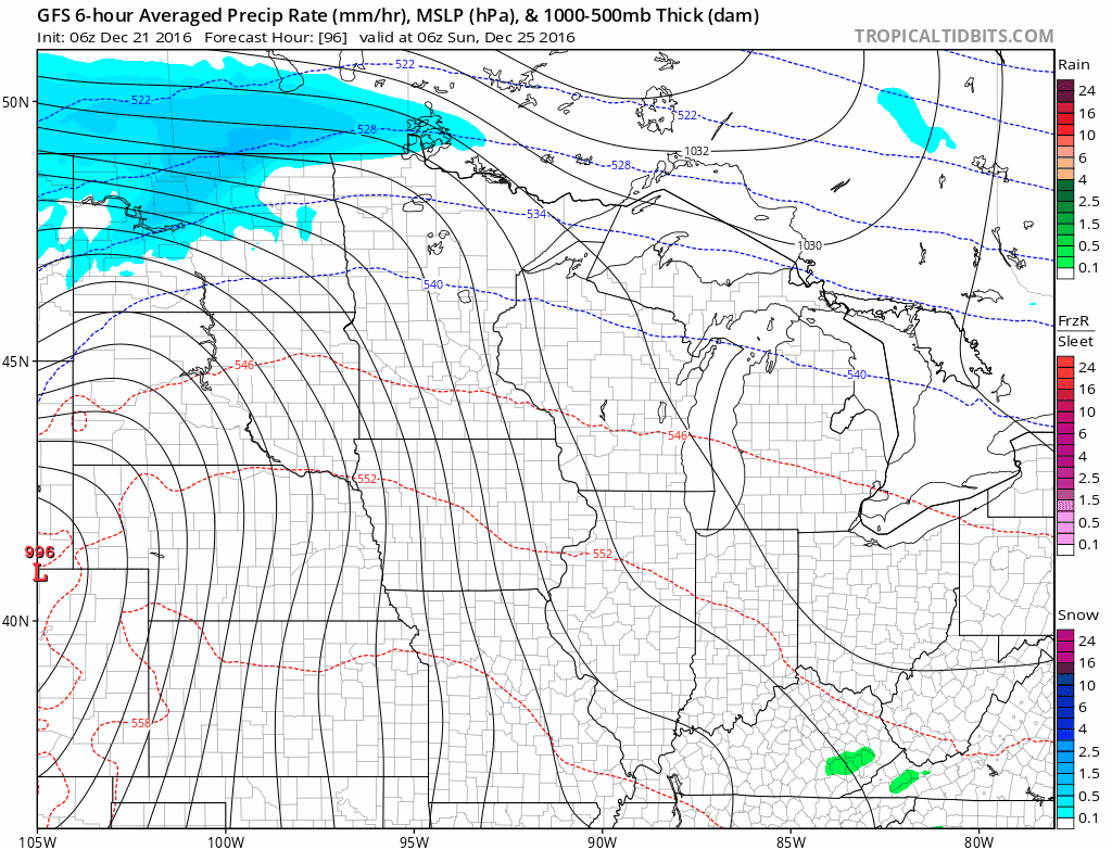
It appears storm dynamics will be strong enough to generate enough lift to produce heavy rain and thunder with this system.
Red River Valley: Heavy snow
It should stay cold enough for all heavy snow in the Red River Valley and northwest Minnesota towns like Warroad, Roseau and Baudette. 1 to 2 foot snowfall totals are quite possible on the colder northwest side of the storm.

Warm surge
The crazy warm dynamic with this system? Watch temps surge well into the 40s to near 50 degrees across southern Minnesota, and above freezing well up north.

Flood potential
Take one part heavy rainfall up to an inch. Throw in another inch of liquid water stored in snow pack on frozen ground. Add a flash thaw with temps into the 40s. Garnish with ice jams on area rivers and you've got some significant flood potential by Christmas night into Monday.
Again, the Twin Cities NWS elaborates.

Holiday travel implications
First the good news. Travel conditions look good Christmas Eve across the Upper Midwest. Christmas day looks white in northwest Minnesota, to wet as you move southeast.
Here's the view for northern Minnesota from the NWS Duluth.

Again, this Twin Cities NWS map gives a good overview of what to expect statewide for Christmas Day travel.

Stay tuned as we follow the models for any possible changes.