Unseasonable warmth now, wintry whispers ahead?
November to remember
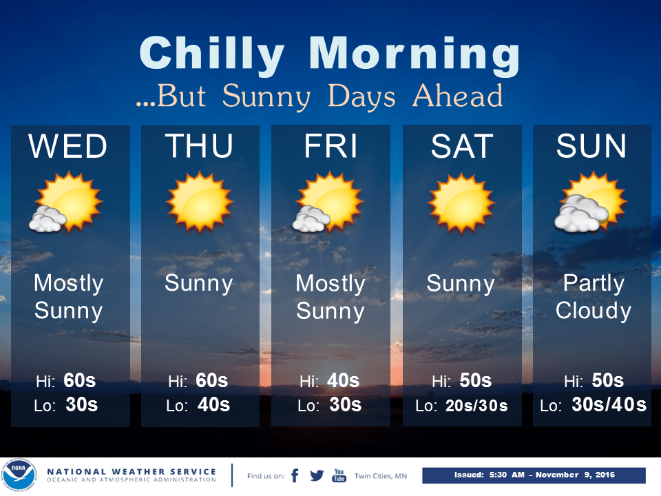
Welcome to yet another sunny, milder than average November day in Minnesota.
Our unprecedented November continues as more warm records accumulate. The warmest start to any November on record. The latest first freeze in Twin Cities history. The longest growing season on record. An overabundance of sunny days in the cloudiest month of the year.
Create a More Connected Minnesota
MPR News is your trusted resource for the news you need. With your support, MPR News brings accessible, courageous journalism and authentic conversation to everyone - free of paywalls and barriers. Your gift makes a difference.
36 degrees - coldest temp at MSP Airport so far this fall (October 24)
November 7th - previous latest freeze on record in the Twin Cities
6 of 9 mostly sunny days in the Twin Cities so far this month (66%)
39% - average amount of possible sunshine in November
210 days - 2016 growing season at MSP Airport
207 days - previous record for longest growing season (1900)
The season formerly known as winter will arrive eventually. NOAA's GFS model continues to hint at potential cold and possible flakes a week from Saturday, and again Thanksgiving week. And even the accuracy of medium-range weather forecast models is looking significantly better than pollsters today.
Something to be thankful for in this month of gratitude.
High and dry
High pressure brings dry skies and more sunny days this week. Watch the next blue H settle over Minnesota by Friday.

Temperatures continue to run 10 to 20+ degrees warmer than average this week from the Minnesota all the way north to the Arctic. Highly unusual.

Wintry whispers on the horizon?
The upper air pattern suggests a 'higher amplitude' flow may be on the way by around November 19th. That would bring colder air...and chances for some snow.

NOAA's GFS model is notorious for overdoing cold air outbreaks in week two. Still, the GFS has been fairly insistent now that temperatures will turn colder by a week from Saturday, with a second cold and snow chance for parts on Minnesota closer to Thanksgiving.

It's too early for high confidence, but odds of a White Thanksgiving for parts of Minnesota may be growing.
Stay tuned.