Nowcast: Strong to Severe storms just south and east of metro through evening

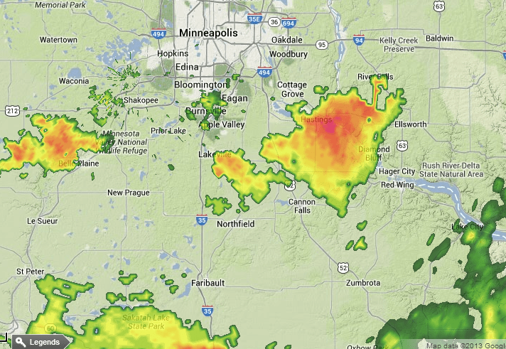
"Hailers:" Most of the storms will develop south and east of the greater Twin Cities metro tonight. The biggest threats are large hail and damaging winds. Here are some early hail reports from NWS spotters.
MPX: 1 N NEW Prague [Scott Co, MN] trained spotter reports HAIL of penny size (M0.75 INCH) at 03:18 PM CDT
MPX: Lakeville [Dakota Co, MN] public reports HAIL of quarter size (M1.00 INCH) at 03:25 PM CDT -- at county road 50 and ipava ave
MPX: Hastings [Dakota Co, MN] public reports HAIL of quarter size (M1.00 INCH) at 04:10 PM CDT -- time estimated
MPX: Hastings [Dakota Co, MN] public reports HAIL of ping pong ball size (M1.50 INCH) at 04:07 PM CDT --
NOAA's SPC has issued a Severe Thunderstorm Watch for areas east of the Twin Cities until 11pm tonight.

Create a More Connected Minnesota
MPR News is your trusted resource for the news you need. With your support, MPR News brings accessible, courageous journalism and authentic conversation to everyone - free of paywalls and barriers. Your gift makes a difference.