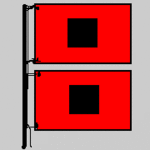
Hurricane Sandy intensifies over 80F Gulf Stream, races toward Jersey Shore

943 millibars Sandy's central pressure on NHC 11 AM EDT update
Record lowest pressure ever recorded in a hurricane north of the Carolinas
90 mph winds Sandy has intensified today to a strong Category 1 hurricane
Create a More Connected Minnesota
MPR News is your trusted resource for the news you need. With your support, MPR News brings accessible, courageous journalism and authentic conversation to everyone - free of paywalls and barriers. Your gift makes a difference.
63 mph wind gust on Long Island at Eaton's Neck, NY
90 mph gusts expected along Jersey Coast tonight
8:53pm EDT Next high tide in New York Harbor
+4 feet Water levels in New York already running 4 feet above predicted level
6 to 11 foot storm surge expected in NYC area at high tide tonight as Sandy nears landfall
7pm to 11pm EDT tonight highest risk for severe storm surge flooding in New York City from Sandy
175 miles distance hurricane force winds extend from Sandy's center
485 miles distance tropical storm force winds (39 mph+) extend from center
50 to 60 mph winds and 25 foot waves...expected on Lake Michigan
Sandy shows intensity "flare"
As Sandy passed over a warm ribbon of water near 80F in the Gulf stream this morning, we see a significant "flare" of intensity in the storms central dense overcast.
Sandy is now a massive well organized storm with a nasty and well defined center. The IR loop even shows signs that Sandy has once again attempted to develop an eye.
[image]
Details from the 11 am EDT NHC discussion.
SANDY IS CURRENTLY TRAVERSING A NARROW RIDGE OF WARM SSTS AROUND 27C...WHICH ARE ASSOCIATED WITH THE GULF STREAM. THIS EXTRA LOW-LEVEL HEAT INPUT HAS LIKELY CONTRIBUTED TO THE RECENT INCREASE IN CONVECTION AROUND THE EYE.
At 90 mph, Sandy is a strong Category 1 storm. With an incredible central pressure of 943 millibars, Sandy has deepened significantly. 943 millibars is the equivalent of a Category 4 hurricane on the Saffir-Simpson Scale.
Since Sandy is no longer purely a hurricane and is transitioning to extra tropical, we can see this kind of pressure...without associated Cat 4 wind speeds.
Still Sandy is a very dangerous storm, and the worst effects still lie ahead in the next 24 to 48 hours.
Sandy will make landfall on the Jersey Coast late tonight.
PH