
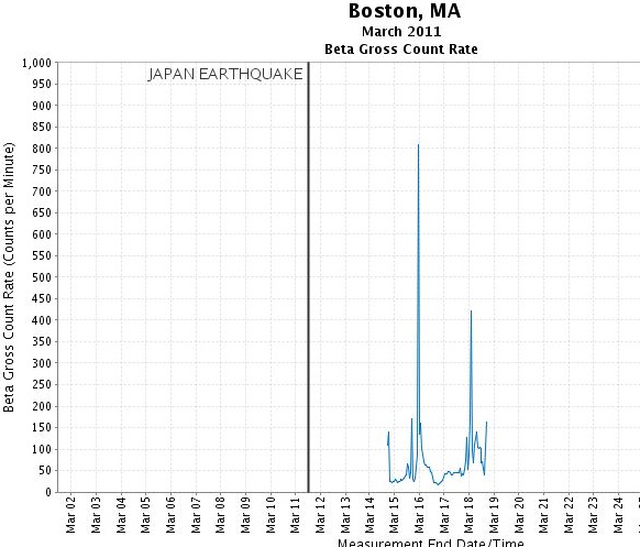
Let’s get this disclaimer out of the way first: Radiation levels in the U.S. from the unfolding nuclear disasters in Japan are way below any unhealthful level. That said, the spike in radiation — even with “not unhealthful” levels — in Massachusetts is intriguing.
Check out this EPA RadNet chart showing the levels post-Japan earthquake (click for larger image):
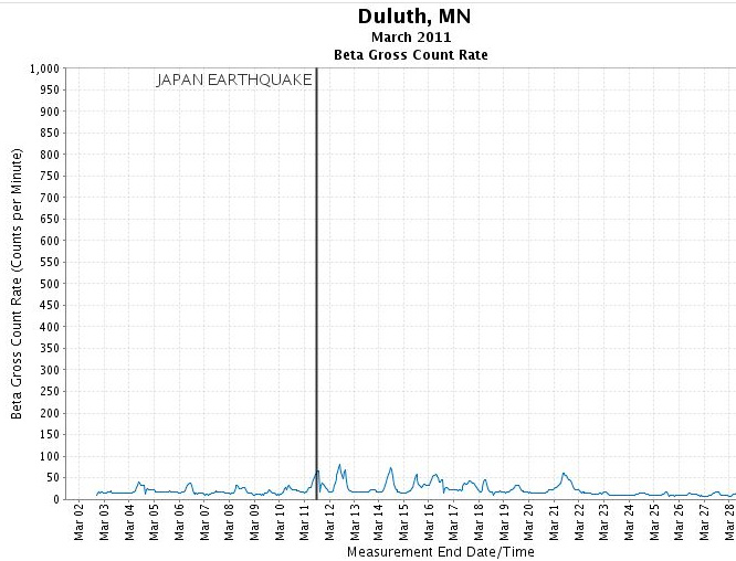
If you’re like me, perhaps you heard the story and figured the radiation got up into the atmosphere and floated across the U.S. to Massachusetts, in which case Minnesota probably would’ve gotten a little too, right? It doesn’t appear so. The EPA monitor near the metro is out of order, but here’s Duluth’s:
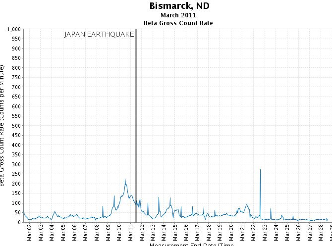
To the west of us, here’s Bismarck:
The EPA says Massachusetts and Pennsylvania are the areas where radiation spiked, probably because of rain:
While short-term elevations such as these do not raise public health concerns – and the levels seen in rainwater are expected to be relatively short in duration – the U.S. EPA has taken steps to increase the level of nationwide monitoring of precipitation, drinking water, and other potential exposure routes to continue to verify that.