Wednesday storm delivers; watching weekend system storm track
Our Wednesday snow fest delivered as advertised by forecast models. Cue the snowplows.
Most of Minnesota picked up significant to heavy snow totals Wednesday. Snowfall totals between 5 and 11 inches are common across Minnesota including the Twin Cities.

Snow tapers off from south to north across Minnesota Wednesday night.
Snowiest February on record
Create a More Connected Minnesota
MPR News is your trusted resource for the news you need. With your support, MPR News brings accessible, courageous journalism and authentic conversation to everyone - free of paywalls and barriers. Your gift makes a difference.
Official snowfall updates from the Twin Cities National Weather Service at Minneapolis-St. Paul International Airport come every six hours. But as of noon, we had already smashed the record for the snowiest February on record at MSP.

We're also in top 10 snowiest of any month territory at MSP airport.
Coming up for air
We catch a break from snow Thursday and most of Friday. Temperatures moderate into the 30s by the weekend. Chilly air greets us again next week. Spring will come, just not soon.

Weekend snow threat: Storm track critical
The latest models show two trends with our potential weekend snow system.
Most models now hold off the snow on Friday's lead wave until later Friday night.
Most models now favor a southeastern track that would lay out the heaviest snow band across southeast Minnesota this weekend.
Let's drill a little deeper into the possible weekend system. The European and Canadian models favor a southern track that would produce less snow -- maybe 1 to 4 inches -- for most of the Twin Cities. The National Oceanic and Atmospheric Administration's Global Forecast System model is the northern outlier. The GFS keeps the Twin Cities on the northern edge of the significant snow zone and suggests several inches in the metro.
Here's NOAA GFS model version of events this weekend.
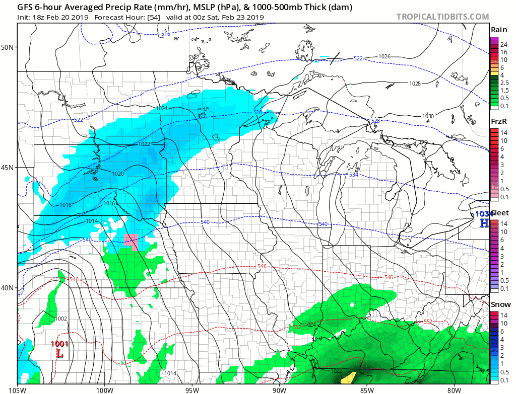
Right now I am leaning toward the more southeast track scenarios that would lay out the heaviest bands of snow this weekend along a line in Minnesota from Albert Lea to Rochester to Winona and onto Eau Claire, Wis. That scenario would produce lighter snowfall total in the Twin Cities.
In theory.
Let's see what tomorrow's model runs bring.