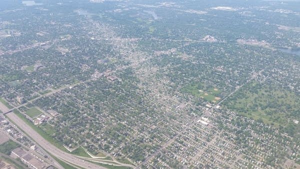
North Minneapolis tornado 7 years ago; steamy and thundery this week
Where were you 7 years ago today?
I was on the airwaves at MPR News tracking a tornado through North Minneapolis on its way to Fridley.

Here's more on the May 22, 2011 tornado from the Minnesota DNR Climate Working Group.
Create a More Connected Minnesota
MPR News is your trusted resource for the news you need. With your support, MPR News brings accessible, courageous journalism and authentic conversation to everyone - free of paywalls and barriers. Your gift makes a difference.
On Sunday, May 22, there were 56 reports of tornadoes extending from northeastern Oklahoma, up the Mississippi Valley to northern Wisconsin. The strongest hit was Joplin, Missouri where 158 people lost their lives and thousands are displaced from their homes. In Minnesota, there were reports in Fillmore, Hennepin, Anoka, and Washington Counties of tornadoes and property damage. Here is a radar image, taken at 2:19 CST on May 22 that shows the pronounced hook echo southwest of Columbia Heights moving to the northwest at 35 miles per hour.
The National Weather Service ranked the strength of the tornado in Minneapolis as an EF1 tornado with winds between 86 to 110 miles per hour. The majority of the damage came from mature trees being uprooted and falling on houses and vehicles. Tragically, one man lost his life when a tree fell on his vehicle in North Minneapolis.
The fuel for these storms came from a strong low pressure system that developed on the lee side of the Rocky Mountains. The counter clockwise rotation associated with low pressure systems allowed the mixing of warm, moist air from the Gulf of Mexico and cool, dry air from the north. As the cold air surged eastward, it lifted the warmer air causing convection and multiple super-cells to develop, spawning the tornadoes
The storms in the Twin Cities took on a familiar path for residents. On May 10, 2011 an EF1 tornado moved through St. Michael, Minnesota tearing the roof off a house and a severe thunderstorm-- close to developing a tornado-- moved northeast through the downtown area causing golf ball sized hail falling on players and fans at the Twins vs. Tigers game. This severe weather event was also caused by a low pressure system that developed on the lee side of the Rocky Mountains and took a similar track across Minnesota, thus leading to the similar storm paths.
Besides the tornado in Minneapolis, there were severe weather reports in other Minnesota locales. Tornadoes were reported in Anoka, Washington, Chisago, Fillmore and Houston counties.

Forecast: Mostly steamy and partly thundery
A hot front gurgles north tonight into southwest Minnesota. Expect a band of showers and T-Storms to bubble up along the front in southwest Minnesota by midnight. Te storms will produce some ,locally heavy downpours, but will likely not reach severe limits. They should fade as they approach the southwest Twin Cities around 6-7 am Wednesday.
Here's NOAA's HRRR model.

Additional rain chances will be spotty this week. The best chance for rains looks like late Thursday night.
Fun with 90s
This first show of summer-like heat in May looks significant. I could see two to four 90 degree days as we slide into Memorial Day weekend. NOAA digital forecast temperatures via Weather Bell.
