Some Sunday T-storms; Monday snowflakes
Minnesota will see the full range of April weather as we go from Sunday into Monday.
Springtime thunderstorms are expected to move across much of southern and central Minnesota Sunday afternoon into Sunday night, and accumulating snow is possible over central and northeastern Minnesota on Monday.
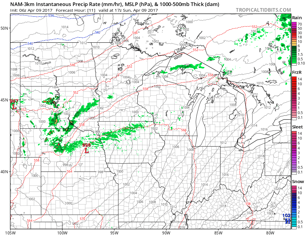
The National Oceanic and Atmospheric Administration’s North American Mesoscale forecast model shows the potential precipitation pattern from Sunday afternoon through Monday evening:

The color chart to the right of the loop refers to the strength of the signal returning to the radar, not inches of rain or snow!
Create a More Connected Minnesota
MPR News is your trusted resource for the news you need. With your support, MPR News brings accessible, courageous journalism and authentic conversation to everyone - free of paywalls and barriers. Your gift makes a difference.
Severe weather risk
The Storm Prediction Center of the National Weather Service shows most of the southern half of Minnesota, plus western Wisconsin, in a slight risk category for severe weather Sunday and Sunday night:

The Twin Cities metro area is included in the slight risk area, and the best chance of thunderstorms in the metro area appears to be from about mid afternoon into this Sunday evening.
The slight risk category means that scattered severe thunderstorms are possible:
Minnesota Public Radio will keep you updated on the thunderstorms that develop.
Weather information will also be posted on the MPR news live weather blog.
The Storm Prediction Center will have updated severe weather info this afternoon and tonight.
You can also check with the Twin Cities office, La Crosse, WI office, Duluth office and Sioux Falls, SD office of the National Weather Service for severe weather updates.
The NWS sites have clickable maps for warnings and forecasts for your specific location.
Monday snow
Much colder air moves into Minnesota late Sunday night and Monday.
The Twin Cities metro area could see a high temp in the lower 50s before sunrise Monday, then temps fall through the 40s during the day.
Highest temps during the daylight hours of Monday will be in the 40s across most of Minnesota, with some 30s over parts of central and northeastern Minnesota.
Rain showers change to snow over central and northeastern Minnesota Monday morning, and periods of snow continue into Monday afternoon.
Some spots in central and northeastern Minnesota could see one to two inches of snow on Monday:

The northern part of the Twin Cities metro area could see some light snow accumulation on grassy areas on Monday.
Rain showers change to a rain/snow mix over the remainder of the metro area by late Monday morning, and the mix could change to light snow before ending late Monday afternoon.
Talk about a weather whiplash, we go from thunderstorms to snowflakes in less than 24 hours!
By the way, the official high temperature in the Twin Cities was 73 degrees on Saturday.
Programming note
You can hear my live weather updates on Minnesota Public Radio at 7:49 a.m. Thursdays and Fridays, and at 7:35 and 9:35 a.m., plus 4:35 p.m., each Saturday and Sunday.