Lots of clouds, shower chance too
Most of Minnesota will have a cloudy Sunday, and we'll also have plenty of clouds on Monday.
Southern Minnesota had some Sunday morning showers, and scattered showers could redevelop Sunday afternoon in parts of southern and central Minnesota.
Play ball
The Minnesota Twin's home opener is Monday afternoon at Target Field.
Create a More Connected Minnesota
MPR News is your trusted resource for the news you need. With your support, MPR News brings accessible, courageous journalism and authentic conversation to everyone - free of paywalls and barriers. Your gift makes a difference.
The first pitch is slated for 3:10 p.m., and it looks like it'll be mostly cloudy with temps in the mid to upper 50s during the game. There's also a chance of a shower.
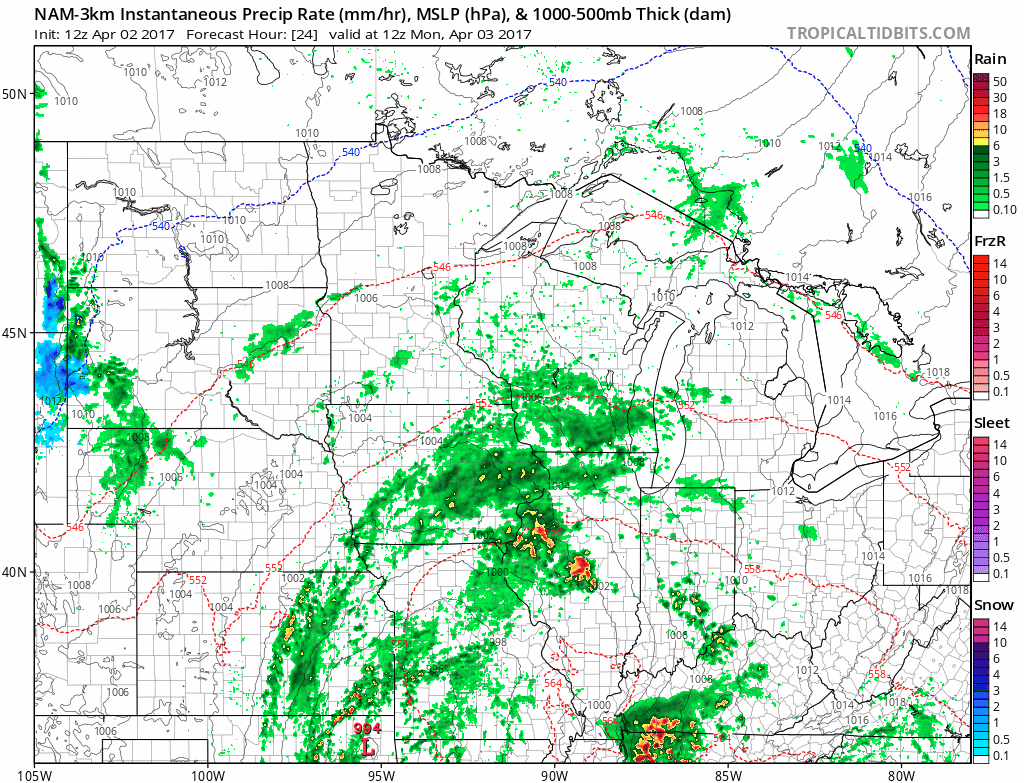
The National Oceanic and Atmospheric Administration’s North American Mesoscale forecast model shows some showers popping up over central and southern Minnesota on Monday:
Above normal
Our average high temperature is 51 degrees in the Twin Cities in early April.
Monday's high will be in the upper 50s in the metro area, with mild high temps statewide:

Tuesday highs reach the upper 50s again in the Twin Cities, followed by lower 50s Wednesday and Thursday.
Twin Cities highs rebound into the upper 50s on Friday, and into the 60s next weekend.
Severe weather southern U.S.
The Storm Prediction Center of the NWS is expecting some areas of severe weather this Sunday afternoon and Sunday night from the eastern part of Texas eastward.
They have focused the severe weather outlook on that area:

Here is the SPC severe weather discussion:
ZCZC SPCPWOSPC ALL
WOUS40 KWNS 021300
ARZ000-LAZ000-MSZ000-TXZ000-021800-
PUBLIC SEVERE WEATHER OUTLOOK
NWS STORM PREDICTION CENTER NORMAN OK
0800 AM CDT SUN APR 02 2017
...Severe thunderstorms expected over parts of the lower Mississippi
Valley region to east Texas today and tonight...
* LOCATIONS...
East Texas
Northern and central Louisiana
Extreme southern Arkansas
Southwest and central Mississippi
* HAZARDS...
Widespread damaging winds, some hurricane force
Several tornadoes, a few intense
Scattered large hail, some baseball size
* SUMMARY...
A severe thunderstorm cluster will likely affect central and
northeast Texas into southern Arkansas and northern Louisiana
today with widespread damaging winds, a few tornadoes, and large
hail. Tornadic supercells will be possible from east central
Texas across central and northern Louisiana, immediately south
of the track of the larger thunderstorm cluster. The risk for
damaging winds and a few tornadoes will persist overnight across
Louisiana and Mississippi.
Preparedness actions...
Review your severe weather safety procedures for the possibility
of dangerous weather today. Stay tuned to NOAA Weather Radio,
weather.gov, or other media for watches and warnings. A watch
means that conditions are favorable for severe thunderstorms
over the next several hours. If a severe thunderstorm warning is
issued for your area, move to a place of safety, ideally in an
interior room on the lowest floor of a sturdy building.
You can check with the Storm Prediction Center for the latest severe weather information.
Programming note
You can hear my live weather updates on Minnesota Public Radio at 7:49 a.m. Thursdays and Fridays, and at 7:35 and 9:35 a.m., plus 4:35 p.m., each Saturday and Sunday.