Winter Storm Watch: Sunday snow chances growing
You knew winter would not go that quietly.
Frigid mid-winter temperatures levels this weekend remind us spring is not here just yet. An Alberta Clipper sails southeast Sunday, a March coating of fresh snow for southern Minnesota's landscape. As usual, the Twin Cities rides the snowy northern edge.
The Twin Cities NWS has posted a winter storm watch for Sunday.
The watch includes the southwest half of the Twin Cities. But with significant track uncertainties still remaining, I'm not ready to fully buy into heavy snow for the metro just yet. But that could change depending on Saturday's model runs.
Create a More Connected Minnesota
MPR News is your trusted resource for the news you need. With your support, MPR News brings accessible, courageous journalism and authentic conversation to everyone - free of paywalls and barriers. Your gift makes a difference.
Low pressure spawns the snow shield tracking into Minnesota and Iowa Sunday.
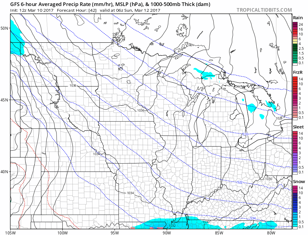
As expected, there is significant model variance once again. NOAA's GFS and the Euro model are relatively close. Both suggest a possible snowfall range of 1" to 3" for the Twin Cities, with heavier snowfall totals of 3" to 6"+ around Sioux Falls, southern Minnesota and northern Iowa.

We'll keep an eye on track changes this weekend, but expect some snowy travel in eastern South Dakota, southern Minnesota and northern Iowa Sunday into Monday.
Model differences next week
All models agree our wintry chill will last through the middle of next week. After that differences begin to appear for next weekend. NOAA's GFS clings to the notion of cold. The Euro likes a warm up into the 50s, maybe even 60 for southern Minnesota. When in doubt, trust the Euro these days.
The upper air pattern favors milder Pacific air by the weekend of March 18-19.

At this point I'm leaning toward the notion of milder air again in about 7-9 days.

Major Nor'easter next week
Our weekend Clipper turns the corner, sucks up massive amounts of moisture from the Atlantic and dumps it on the northeast next week.

There are still rain/snow line questions for NYC, but 1-2 FEET of snow looks likely inland toward Philly.

This looks like a crippling snow event and potential blizzard for parts of the northeast. The Euro brings snowfall to the coast. This will be the big national weather story in the next 72 hours.
I don't recycle and carry over the same stories in Updraft day after day like some weather bloggers to pad out my posts. Here's a few fresh perspectives and stories that caught my eye today.
Kansas wildfires torch half a million acres
The incredible Midwest warmth that baked Minnesota last month created the perfect firestorm in Kansas. It's the biggest fire in Kansas history.
The climate connection with unusual and extreme events like this is growing.
Weather Channel vs. EPA's Pruitt: New perspectives
Many in the climate science community are wondering how it can be that we're still trying to explain to some that the earth isn't actually flat. The Weather Channel does a good job with this piece.
In fact if you look at 'natural' atmospheric forcing factors alone, the earth should be in a cooling phase.
Instead of cooling we've just recorded the 3 warmest years on record. Back. To back. To back. Something besides natural forcing is driving a warmer planet earth. That something can only be the rapid and massive human injection of greenhouse gasses into our atmosphere.
