Spring temperature speed bump now, rain by Thursday
Welcome to the Minnesota spring two-step: two steps forward, one step back.
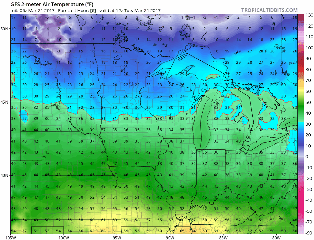
Spring typically comes in fits and starts at this latitude. In our current context that means pulsing shades of blue stubbornly cling to the weather maps over Minnesota through tomorrow.
April showers arrive early
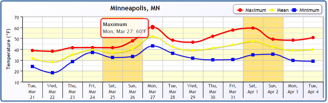
Temps moderate late this week into the 50s once again. A slow moving low pressure system crawls through Iowa. Scattered showers develop Thursday. Steadier soaking rains cover southern Minnesota Friday. A few showers linger into Saturday.
Create a More Connected Minnesota
MPR News is your trusted resource for the news you need. With your support, MPR News brings accessible, courageous journalism and authentic conversation to everyone - free of paywalls and barriers. Your gift makes a difference.

Late March soaker
Yes, this probably should be snow in Minnesota in late March. Not this year. Though some wet snow may develop on the northern fringes, this system looks to produce mostly rain. We'll probably see some 1 inch-plus totals across southern Minnesota and the Twin Cities by Saturday.
Milder by Monday?
Our spring warm-up looks like a slow process this year. But the weather maps do show signs of easing some milder air in here once again by Sunday and Monday; 60 may be a bit optimistic by Monday, but it should feel considerably milder out there.
Brighter days
The undeniable fact this time of year? It can't stay cold much longer. The sun's rays are now equal to Sept. 20. The sun climbs ever so slightly higher in the sky with each passing day. Daylight continues to grow at about three minutes a day. We are now entering the brightest six months of the year in Minnesota.
You'll need the winter jacket today, but keep the umbrella handy for later this week.