Friday thaw; Winter about to go out like a lamb?
It figures Minnesotans would come up with a way to quantify our collective 'winter misery.' So far the numbers show we're getting off fairly easy this winter. It's no surprise the "Winter Misery Index" puts the Twin Cities squarely in the "mild" category so far.
No matter how you measure it, this has been a relatively mild winter compared to the season formerly known as winter in Minnesota.
Cue the next thaw
So it should come as little surprise that yet another thaw is on the way. Temperatures across Minnesota actually rise overnight into Friday morning. It's a process we meteorologists lovingly refer to as "warm advection." Watch the milder Pacific air spill in overnight into Friday.
Create a More Connected Minnesota
MPR News is your trusted resource for the news you need. With your support, MPR News brings accessible, courageous journalism and authentic conversation to everyone - free of paywalls and barriers. Your gift makes a difference.
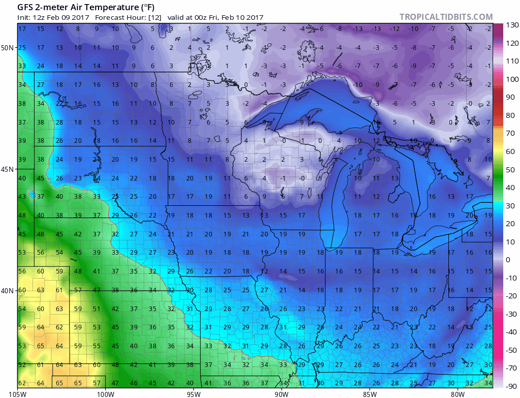
20 degrees warmer than average Friday?
Forecast models still tend to underestimate extreme but increasingly likely "out of season" warm and cold snaps. Most of the forecast models suggest highs in the upper 30s Friday afternoon. But with a little sun, the inbound air mass is more than capable of mid 40s in the Twin Cities around 3 pm Friday. Bank thermometers in Worthington and Canby could flash 50 Friday afternoon.
In fact Friday's weather maps look more like late March across the Upper Midwest. The upstream air mass will produce 70s within a day's drive of Minnesota. An early spring break in Nebraska anyone?

Disappearing snow cover
This week is close to the peak of average snow depth across Minnesota in winter.
But the ground truth this winter is snow cover has been hard to keep across central and southern Minnesota. The lack of persistent snow cover is growing trend in winter across Minnesota, and this winter fits the trend of recent winters. Running your Polaris or Arctc Cat across southern Minnesota this week may cost you a trip to the maintenance shop.

Even milder next weekend
This weekend looks mild with temps running a good 10 to 20 degrees warmer than average across Minnesota. But next weekend could be even warmer. The upper air pattern by February 19th looks more like early April. The jet stream is long gone on Canadian vacation. A mild Pacific ridge rules the central USA. This is not normal for February!

The warmth may last right into the end of February. Here's the same map 4 days later. Unreal.

Most models are cranking out more 40s, and I won't be shocked at 50s by the weekend of Feb 18-19.

If early March come in milder than average as expected, what we saw this week may be the coldest air mass we will see the rest of this winter.
Stay tuned.