Periods of light snow; milder temps
A January weather formula in Minnesota might look like this: warmer temperatures = a chance of snow.
It doesn't always work out that way, but it will today.
Two rounds of snow
A cold high pressure system is moving away, and an approaching low pressure system will spread light snow into southwestern Minnesota by early afternoon. The light snow will expand northeastward from there to cover much of Minnesota and western Wisconsin by late afternoon.
Create a More Connected Minnesota
MPR News is your trusted resource for the news you need. With your support, MPR News brings accessible, courageous journalism and authentic conversation to everyone - free of paywalls and barriers. Your gift makes a difference.
The Twin Cities metro area could see periods of light snow from about mid afternoon into this Sunday evening.
The National Oceanic and Atmospheric Administration’s North American Mesoscale forecast model shows the potential snow pattern:
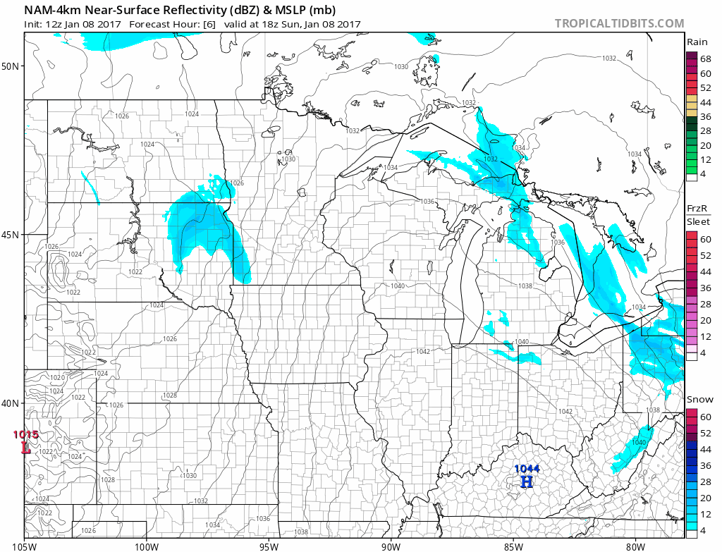
The color chart on the lower right of the loop refers to the strength of the radar signal returning to the radar, not inches of snow!
Another batch of snow is expected from Monday afternoon into Tuesday morning.
The National Oceanic and Atmospheric Administration’s Global Forecast System model shows the potential precipitation pattern for that event:

Parts of southern Minnesota could also see some freezing rain or sleet Monday night.
Some slippery roads are possible during our Monday evening commute.
We aren't expecting a lot of snow, but the two snow events could combine to give us a couple of inches.
NOAA's snowfall "plume" shows the snow accumulation from later today through Tuesday:

The solid black line shows the average snow total of various versions of forecast models.
It shows light accumulation later today, then total accumulation of around 2 inches by Tuesday afternoon.
We will keep an eye on this as new forecast model info comes in.
Milder temps
Minnesota will see Sunday afternoon highs in the teens, and a few spots in southwestern Minnesota could touch 20 degrees.
Monday will feature lower 20s over parts of southern Minnesota, with teens elsewhere:

Tuesday highs will be similar:

The Twin Cities metro area will see highs in the teens on Wednesday and Thursday, then single digit highs on Friday and Saturday.
Chilly morning in the South
It was unusually cold all across the southern part of the U.S. this Sunday morning.
Freeze advisories or hard freeze warnings extended from south Texas to north Florida:

Most of Florida was also in a wind chill advisory (light blue shade) Sunday morning, with wind chill temperatures in the 20s above zero.
Western flooding
California and parts of Nevada are bracing for another round of heavy rain.
Heavy snow is expected in some mountain areas.
Some areas have already seen flooding, and additional flooding is possible:
Programming note
You can hear my live weather updates on Minnesota Public Radio at 7:35 a.m. and 4:35 p.m. each Saturday and Sunday.