Nuisance snows, slick roads; January thaw in sight
Welcome to the dead of winter. We now enter the two coldest weeks of the year on average. Our average high is stuck at at 23 degrees in the Twin Cities through Jan. 18. Starting Jan. 19 our daily average temperature begins to nudge up ever so slightly.
A series of nuisance snows light up the Doppler this week. The first wave arrives in the Twin Cities around lunchtime, just enough to slick up roads heading into afternoon rush hour. Enough warm air mixes in for some icing overnight tonight. We pick up another inch or two tomorrow, then another Wednesday.
Our next subzero arctic front blows into town Thursday into Saturday. Temperatures push minus 20 in a few north metro suburbs Friday and Saturday morning before moderating next weekend. I still see a significant January thaw the weekend of Jan. 21-22 when it may be warm enough for rain in the Twin Cities.
Minnesota Twins pitchers and catchers report in 36 days, on Feb. 13.
Create a More Connected Minnesota
MPR News is your trusted resource for the news you need. With your support, MPR News brings accessible, courageous journalism and authentic conversation to everyone - free of paywalls and barriers. Your gift makes a difference.
The jet stream waffles overhead this week. A series of ripples aloft spawns multiple light snow events today through Wednesday. The National Oceanic and Atmospheric Administration's Global Forecast System model captures the essence of multiple waves of light snow, with some icing potential overnight tonight.
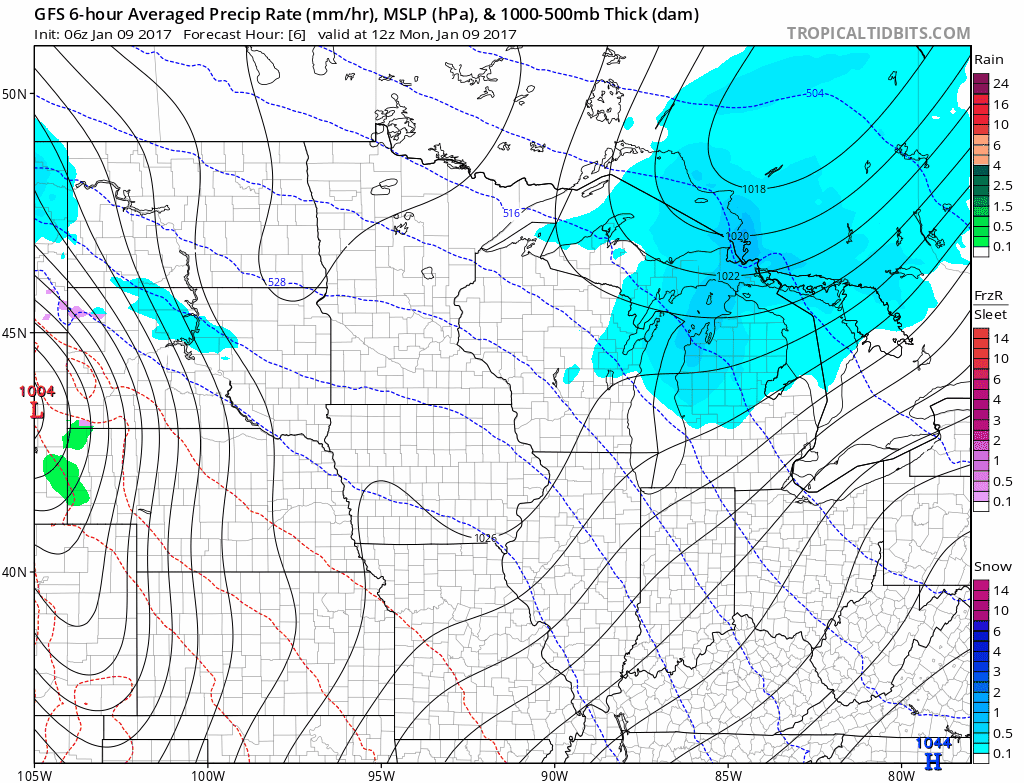
An inch here, a candy-coating there. The snow adds up to a general 2- to 5-inch range around the Twin Cities this week. Heavier totals fall into Wisconsin where a foot may pile up by Friday. The plows will be out this week.

Arctic front
The next arctic shot will get your attention by Friday. This shot of air will actually be colder than anything we saw last week, but will not last as long. I can see minus 30 to minus 40 up north, with minus 20 in the metro burbs and minus 15 in the inner downtown core Friday morning. Our second run at minus 20 this winter in the Twin Cities?

January thaw still in sight
Last week I wrote about a January thaw on the horizon for late next week. It still looks like we're on track for significant thaw last next week into the weekend of Jan. 21-22. The upper air maps show a very mild southwest flow overhead in about 10 to 14 days.

The early read on temperatures for this year's January thaw looks like several days above freezing, with highs in the upper 30s, perhaps pushing into the 40s.
NOAA's GFS model output will change from day to day over the next week, but forecast models are much better at picking up on temperature trends vs. day to day rain or snow events one to two weeks out.

Warm February?
Looking even further ahead, the early outlook for February suggest milder than average temperatures next month. NOAA's CFS-2 paints a sea of mild air, with temperatures 2 to 6 degrees warmer than average across North America next month. Could winter go out like a lamb?

Stay tuned.