A few flakes today; enough to shovel Saturday?
It looked like we were inside a snow globe yesterday, with fluffy flakes dancing in the cold wind.
We'll have occasional light snow or flurries today, but some more significant snow is possible Saturday and Saturday night.
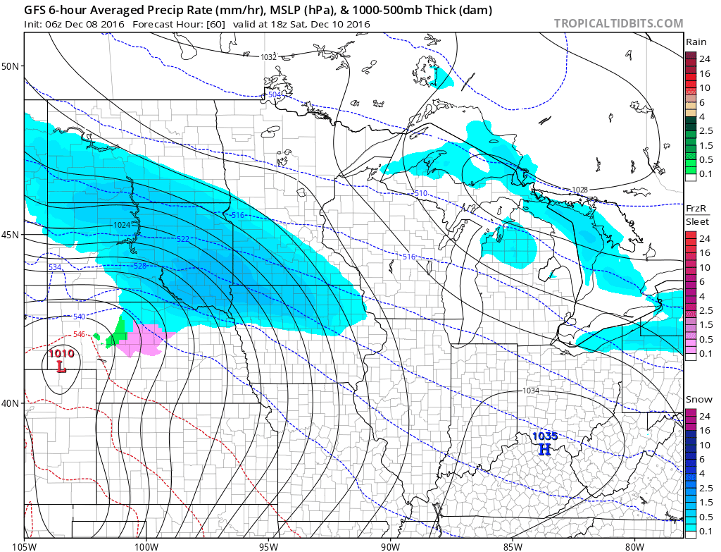
The National Oceanic and Atmospheric Administration’s Global Forecast System model shows snow spreading across Minnesota Saturday afternoon and continuing into Saturday night:
How much snow will we get?
Create a More Connected Minnesota
MPR News is your trusted resource for the news you need. With your support, MPR News brings accessible, courageous journalism and authentic conversation to everyone - free of paywalls and barriers. Your gift makes a difference.
Here are your chances of 4 or more inches, per the Twin Cities office of the National Weather Service:
The various versions of forecast models show a wide range of snow totals for the Twin Cities:

The average of the forecast models is about 5 inches, but the heaviest snow could very well shift south.
The European Centre for Medium-Range Weather Forecasts model shows less snow for the Twin Cities.
It will be fun to see if the forecast models converge as we get closer to the weekend!
December is second snowiest
According to the Minnesota State Climatology Office, December is the second snowiest month of the year in the Twin Cities:

We average 11.5 inches of snow in December. On average, January is our snowiest month, with 12.1 inches.
March is our third snowiest month, with 10.2 inches.
The 30-year averages of monthly snowfall are updated every 10 years, with the oldest 10 years removed and a new 10 years of data added.
Last December we had 9.5 inches of snow in December, but about 8 inches of that total fell after Christmas.
There was only a trace of snow on the ground last Christmas morning at Minneapolis-St-Paul International Airport.
Cold stretch
Highs today will be in the teens to lower 20s:

That's cooler than our average high of 29 for today, and wind chill temps will be in the single digits.
Some spots in Minnesota will see wind chills below zero today.
High temps tomorrow will be cooler:

No big warmup is in sight, with highs mostly in the teens this weekend.
The cold weather will linger into the third week of December.
NOAA's Climate Prediction Center temperature outlook for Dec. 15-21 shows a high probability of colder than normal temps over Minnesota:

Let's hope for some moderation later in the month!