Fine summer weekend, Atlantic storm potential next week?
Timing is everything in weather, and life.
Early this summer, Minnesota enjoyed a run of spectacular summer weekends. The past few weekends featured some gnarly storms, including last Saturday's mega-downpour. This weekend we enjoy some of the fairest summer weather Minnesota has to offer.

High and dry
High pressure on the weather maps means fair weather. No angry red splotches on Doppler to drowned out your weekend plans this weekend. A stalled front keeps all the heavy-rainers south of Minnesota the next few days.
Create a More Connected Minnesota
MPR News is your trusted resource for the news you need. With your support, MPR News brings accessible, courageous journalism and authentic conversation to everyone - free of paywalls and barriers. Your gift makes a difference.

Multi-inch rains drench the central plains and east coast the next 3 days.

Wet July
We can use a few dry days across most of Minnesota. Much of central Minnesota has seen more than 5 inches of rain in July. Here's the July rainfall map from the Midwest Regional Climate Center.

Warmer and more humid next week
Heat and humidity increase next week across Minnesota. The upper air charts show the hot ridge pulsing shades of red north into Minnesota once again next week.

It's not the heat, it's the humidity. Or more specifically the dew point. Back in the day at WCCO-TV in the 80s I spent a lot of air time explaining why dew point is a better measure of human comfort than relative humidity to viewers. We've come a long way since then. Now most Minnesotans routinely talk about dew points as a measure of comfort. When the dew point htis 70, Minnesota feels more like Miami.
Dew points in the 50s mean you can likely give your AC unit a rest into Saturday. You'll notice dew points rising again by Sunday. Tropical dew points in the 70s degrees return next week. As the Germans say, the air will be "close."

Warm next week than cooler again?
I expect we'll add 1 or 2 more 90+ days next week in Minnesota. The longer range maps still suggest a cool down as we move deeper into August. 50s a few mornings may serve as a reminder that September is just 5 weeks away.

Atlantic heating up next week?
The tropical Atlantic has been remarkably quiet this season. But two tropical waves moving off Africa's west coast have some development potential in the next week.
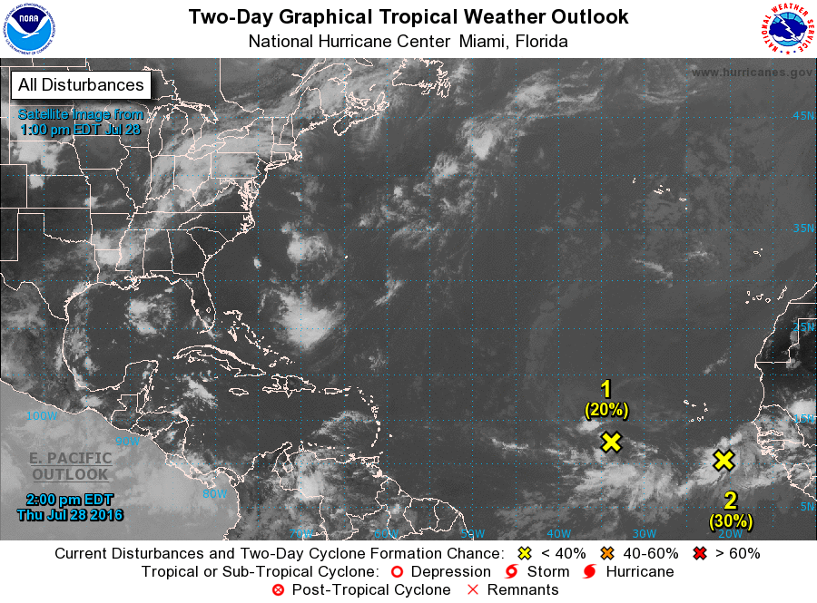
Weather Undergrounds hurricane specialist Jeff Masters elaborates on development potential.
Steering currents favor a west to west-northwesterly motion at 10 - 20 mph for 96L over the next five days, and the storm should reach a point near 40°W, midway between the Lesser Antilles Islands and Africa, on Sunday. The 8 am EDT Thursday run of the SHIPS model predicted modestly favorable conditions for development through Saturday morning, with wind shear in the light to moderate range, 5 - 15 knots, a moist atmosphere, and warm SSTs near 27.5 - 28°C (81 - 82°F.) However, on Saturday and Sunday, 96L will encounter cooler waters, with temperatures a marginal 26.5 - 27°C (80 - 81°F). The SHIPS model also predicts that wind shear over the weekend will become moderate to high, 15 - 25 knots, and the atmosphere will get very dry, due to an intrusion of the Saharan Air Layer (check out the 10-day African dust forecast from NASA.) These unfavorable conditions would stymie any development of 96L.
As we say in the weather biz, stay tuned.