Snowy dusting here, East Coast Snowmageddon looms
Minnesotans may be coming down with a serious case of snow-envy this weekend.
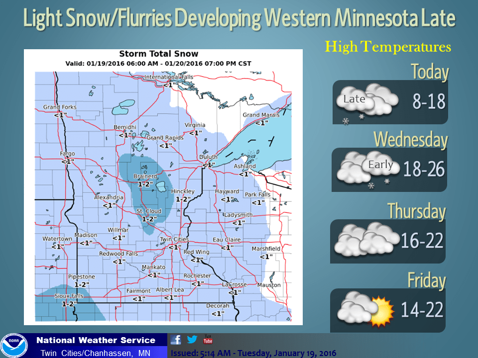
A minor snowy dusting sweeps across Minnesota from west to east late this afternoon and evening. Snow totals again are less than an inch in most areas. Still, with temperatures around 10 above this may be another low snow-high impact event on roads by tonight.
Take it Easy out there this evening.
Warming trend kicks in
Create a More Connected Minnesota
MPR News is your trusted resource for the news you need. With your support, MPR News brings accessible, courageous journalism and authentic conversation to everyone - free of paywalls and barriers. Your gift makes a difference.
Thermometers respond to a more typical January levels this week. Sub-zero air exits the Upper Midwest. Mid-2os will feel amazing as soon as tomorrow. The Heat is On with 33 degrees feeling like a major heat wave by Sunday afternoon.

17.2 inches winter season snowfall so far at Minneapolis-St. Paul International Airport
29 inches average season snowfall to date at MSP
-11.8 inches snow deficit this winter so far
Snow drought continues
Many Minnesotans are pining for a little more snow. I'd be looking at the weather maps with Lyin' Eyes if I told you I see any big storms right now.
The longer range forecast continues to look quiet for Minnesota. Upper air patterns continue to favor a relatively dry westerly flow for Minnesota for the foreseeable future. The good news? There is plenty of snow to play in up north including 21 inches at Wolf Ridge ELC near Finland and 13 inches-plus from Ely eastward. It's a Peaceful easy Feelin' in the north woods these days.

East Coast braces for Snowmageddon
Meanwhile the twitterverse is abuzz with news of a major East Coast snow event this weekend.
A powerful low pressure system looks likely to explode into a major nor'easter Friday and Saturday off the East Coast. Gusts to near hurricane force and storm surge will lash the Jersey Coast.

The rain-snow line may hug the coast with this system. That may keep snowfall totals low in coastal areas near Washington, D.C., New York and Boston. But inland locations like Philly should be all snow, and it could be a pile of 1 to 2-plus feet with this one.
Snowmageddon party anyone? Pass the Tequila Sunrise.

Expect increasing wall to wall coverage in national media as what could be the biggest snow event of winter takes aim at the east coast this weekend.
Thanks for the incredible creativity and music Glenn Frey. Rest in peace.