A wind-whipped cooldown
How about that toasty Sunday we just enjoyed! While the Twin Cities warmed to a record 85 degrees, just past the old mark of 84, the tongue of hottest weather was to the west and north of the metro. Low 90s were recorded at airports such as Redwood Falls, Montevideo, Ortonville, Morris, Benson and Bemidji. Appleton got 95. Wheaton in west central Minnesota was the state's hot spot with 97.
I am not sure how widespread it was, but early Sunday afternoon our neighborhood in Minneapolis suddenly was swarming with little flying creatures about 1/3 of an inch long. They were flying all around in no apparent pattern, landed on us at times, and were strongly attracted to the light-colored paint on the sunny side of our house. Although I am a meteorologist and not an entomologist, my guess is that they were multicolored Asian lady beetles, a type of non-native, invasive ladybug. According to the University of Minnesota Extension Service (their image below), they can have spotted or almost plain wings. Identification for amateurs is mainly from the white area behind the head that contains a marking in the letter "M" as identified by the arrow.
[image]
From the excellent summary from the Extension Service, they are a fairly recent arrival in our state and appear in large numbers in the fall, generally on the second consecutive day warmer than 65 degrees following a period of chilly nights. They are attracted to the sunny sides of light-colored buildings with contrasting dark areas. They are looking for ways to get into the building for shelter during the upcoming winter. While they rarely bite, they emit a stinky goo when defensive or are smashed.
Create a More Connected Minnesota
MPR News is your trusted resource for the news you need. With your support, MPR News brings accessible, courageous journalism and authentic conversation to everyone - free of paywalls and barriers. Your gift makes a difference.
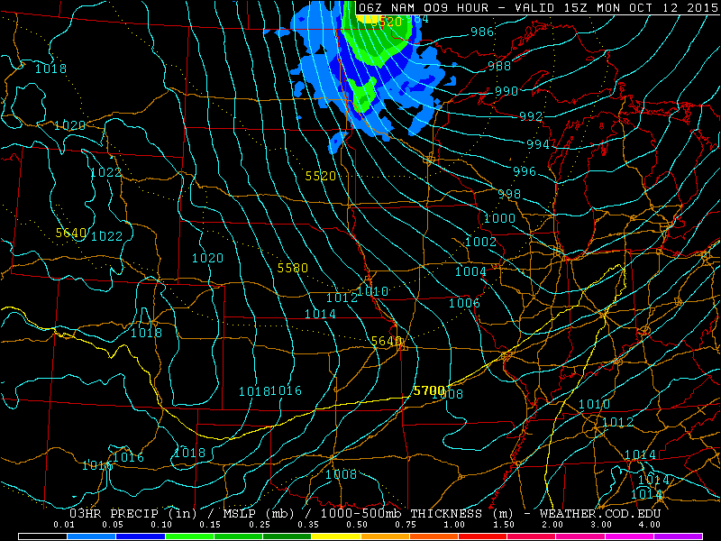
A cold front blew across Minnesota and Wisconsin overnight. Winds from the northwest were quite strong just behind the front. Alexandria reported a gust to 55 mph Sunday evening after frontal passage.

Much chillier Canadian air will sweep across Minnesota today. Afternoon temperatures will be just in the 50s in most of the state. Parts of northwestern Minnesota, closest to the core of the cold air, are likely to enjoy an afternoon in the 40s--nearly 50 degrees colder than yesterday.
The other big weather story will be the wind. West and northwest winds are already gusting in excess of 40 mph in western Minnesota and will move into the eastern half during the morning. Sustained winds of around 4o mph with gusts of 50 to 65 mph are likely in the open country of western Minnesota today. Warnings and advisories have been issued, and blowing dust could limit visibilities at times since the ground is rather dry.

A wind advisory has been issued for areas east of the high wind warning, including all of the metro area, for today. Sustained winds of 30 to 40 mph are likely with gusts in open areas of around 50 mph.

As far as precipitation is concerned, scattered showers now in northwestern Minnesota will spread across mainly the northern half of the state today. Rainfall amounts should be mostly light.

The next chance of showers is expected on Thursday.