Growing buzz around potential “Super El Nino”
Climate watchers have been buzzing for months now about a possible strong El Nino event in the tropical Pacific.
Lately that buzz has escalated to a din.
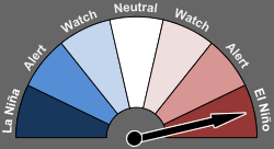
Officially El Nino
All of the so called "Nino regions" now show tropical Pacific sea surface temperatures (SST) well above the El Nino threshold of +0.5C. Some numbers from NOAA's latest El Nino Diagnostics Discussion.
Create a More Connected Minnesota
MPR News is your trusted resource for the news you need. With your support, MPR News brings accessible, courageous journalism and authentic conversation to everyone - free of paywalls and barriers. Your gift makes a difference.
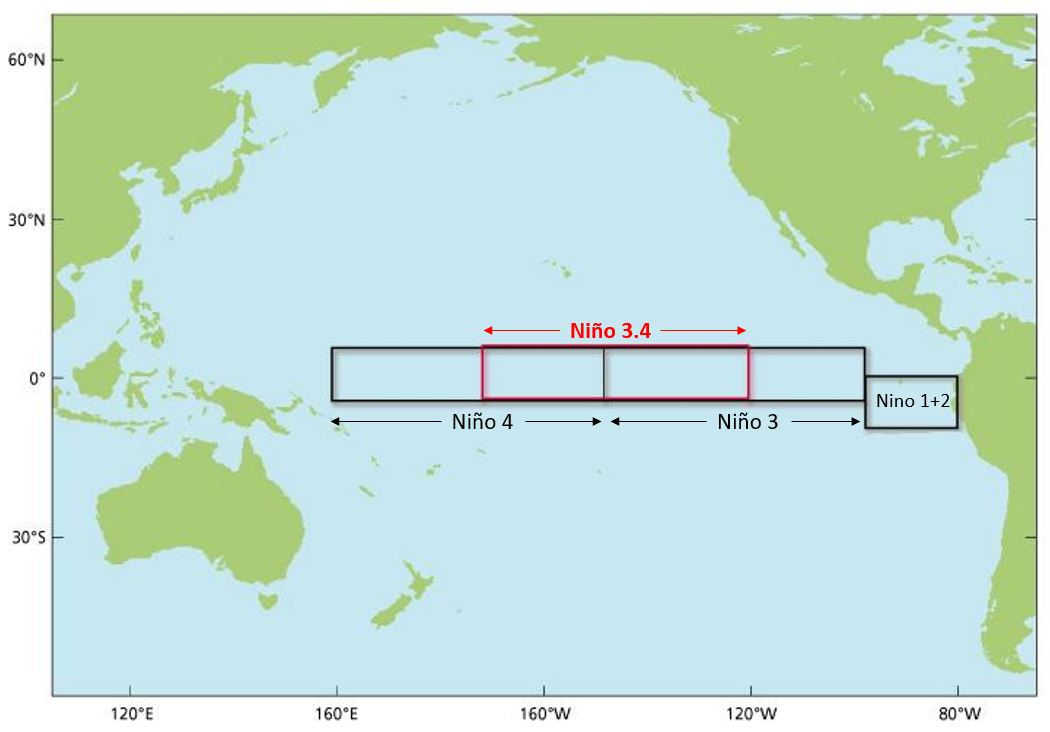
By early May 2015, weak to moderate El Niño conditions were reflected by above-average sea surface temperatures (SST) across the equatorial Pacific (Fig. 1), and by the corroborating tropical atmospheric response. The latest weekly Niño indices were +1.2°C in the Niño-4 region, +1.0°C in the Niño-3.4 region, and +1.2°C and +2.3°C in the Niño-3 and Niño-1+2 regions, respectively.
The rapidly deepening ribbon of significantly warmer than average water in the tropical Pacific is clearly evident on the weekly SST animation.

NOAA is increasingly bullish on the odds for El Nino to persist through 2015.
Synopsis: There is an approximately 90% chance that El Niño will continue through Northern
Hemisphere summer 2015, and a greater than 80% chance it will last through 2015.
Super El Nino event ahead?
A growing number of climate models from NOAA and the Australian Bureau of Meteorology (BOM) show increasing chances of a rare "Super El Nino" event. Some models now predict a "very strong" El Nino event cranking out greater than +2.0C SST this fall into winter. There is some buzz in climate circles that this has a chance to be the strongest El Nino on record.

NOAA and other forecasters caution that skill in predicting the eventual peak magnitude of El Nino events is dicey.
Given these factors, it is likely that SST anomalies will continue to increase in the coming months. However, model forecast skill tends to be lower during the Northern Hemisphere spring, which somewhat limits confidence in these forecasts. Therefore, there remains considerable uncertainty about how strong this event may become.
The Australian Bureau of Meteorology model average also shows a strong to potentially very strong (+2.0C) El Nino event ahead.

This magnitude of El Nino event has only been recorded twice in the past few decades; in 1982-83 and 1997-98. Both events had dramatic effects on weather patterns including devastating floods in California.
Capital Weather Gang's Jason Samenow elaborates on the rarity of so called super El Nino events.
Very strong or “super El Nino” events fall at the most intense end of the El Nino spectrum, which starts at weak and then steps up through moderate and strong levels. Only two events in modern records have ever achieved “very strong” intensity were the events in 1982-1983 and 1997-1998, which was the strongest on record. The 1997-1998 event is well-known for contributing to torrents of rain in California, leading to $550 million in damages.
(Note that El Nino events earn their strength designations according to how much warmer than normal ocean temperatures are in a section of the east central tropical Pacific, known as Nino region 3.4. A weak event has ocean temperatures 0.5-0.9 C warmer than average, a moderate event 1.0-1.4 C warmer than average, a strong event 1.5-1.9 C warmer than average and very strong more than 2 C above average.)
California Dreamin' of El Nino?
The biggest winner from a potentially massive El Nino event could be California. The drought ridden state could see massive (flooding) rains and deep mountain snow pack from a big El Nino event, but likely not until next fall and winter. Nearly half of California now suffers in the worst "exceptional drought" category on the latest US Drought Monitor.

For Minnesota and the Upper Midwest, the odds of a milder than average winter next year are increasing by the day.

The two previous "Super El Nino" winters in Minnesota were extremely mild.
In the Twin Cities, meteorological winter (Dec-Feb) 1982-83 was 5.3 degrees warmer than the 1981-2010 average. December through January 1997-98 was an astounding 7.3 degrees warmer than the 1981-2010 average.
NOAA's Climate Forecast System (CFS) is forecasting a mild bias for the Upper Midwest heading into next winter.

Next update critical
The next round of ENSO updates in the next two weeks could increase forecaster confidence as we move past the so called "spring predictability barrier" for El Nino. The Aussie Bureau updates June 9th. NOAA's June update arrives the following week.
Expect a fresh round of national and international news headlines as June's El Nino update may turn some heads.