October preview: Rain, wind and cold ahead
Our rapidly deepening storm system winds up and takes a swing at Minnesota through Wednesday.
There are major model differences (what's new?) on the precise track and rainfall totals for the Twin Cities, but the overall picture of a surge of wet weather followed by gale force winds and plummeting temps remains the same.
Get ready for an early taste of October.
Storm headlines:
Create a More Connected Minnesota
MPR News is your trusted resource for the news you need. With your support, MPR News brings accessible, courageous journalism and authentic conversation to everyone - free of paywalls and barriers. Your gift makes a difference.
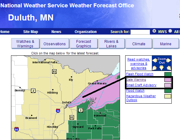
Flash flood watches posted for southeast Minnesota, Iowa and Wisconsin (rainfall totals of 2 to 4 inches possible)
Gale warnings posted for Lake Superior ( 9- to 11-foot swells along the North Shore Wednesday)
Rain, gusty northeast winds and falling temps into the 50s Wednesday across Minnesota
Round No. 1 with this system rolls in with rain and thunder overnight into Wednesday morning. A southerly storm track puts the favored zone for the heaviest rain and storms in Iowa and southeast Minnesota. Here's the read on flooding and storm potential with the incoming system from the La Crosse office of the National Weather Service.

Flash flood watches cover a big chunk of real estate across Iowa, southeast Minnesota and Wisconsin. The watch zone borders the eastern Twin Cities metro area.

FLOOD WATCH
NATIONAL WEATHER SERVICE TWIN CITIES/CHANHASSEN MN
315 PM CDT TUE SEP 9 2014
...WIDESPREAD RAINFALL TONIGHT ACROSS SOUTHERN AND EASTERN MINNESOTA AND WESTERN WISCONSIN...
A POWERFUL STORM SYSTEM WILL BRING WIDESPREAD RAINFALL ACROSS THE UPPER MIDWEST. THE HEAVIEST RAIN WILL OCCUR IN SOUTHERN IOWA. HOWEVER MODERATE RAINFALL IN SOUTHERN MN AND NEAR THE MN/WI BORDER OVER SEVERAL HOURS COULD RESULT IN 1 TO 2 INCHES OF RAIN...WITH UP
TO 3 INCHES POSSIBLE. THIS WOULD LEAD TO PONDING OF WATER IN LOW LYING AREAS AND INTERSECTIONS...WITH MORE SIGNIFICANT FLOODING ISSUES POSSIBLE SHOULD GREATER PRECIPITATION AMOUNTS OCCUR.
Here's the weather culprit. A deepening low slams the Upper Midwest by Wednesday morning. Here's the surface low position at 7 a.m. CDT Wednesday.

Model Differences:
There are some significant differences between the Global Forecast System and North American Mesoscale Forecast System regarding storm track. Both models suggest the heaviest rains over southeast Minnesota and Iowa into Wisconsin, but the more southerly GFS track would produce less rainfall for the metro. here's the model output meteogram from Iowa State University.

The bigger picture shows why flash floods are a real possibility south and east all the way into Illinois.

Gales of October come early
Things get rough on Lake Superior over the next 24 hours. A tightening northeast pressure gradient will drive winds to near 50 mph at times on the big lake. Gale warnings have been hoisted for Lake Superior by the Duluth NWS.
URGENT - MARINE WEATHER MESSAGE
NATIONAL WEATHER SERVICE DULUTH MN
338 PM CDT TUE SEP 9 2014
...GALE FORCE WINDS EXPECTED OVER WESTERN LAKE SUPERIOR BY LATE
THIS EVENING AND CONTINUING THROUGH WEDNESDAY...
A STRONG LOW PRESSURE SYSTEM WILL TRACK NORTHEAST FROM IOWA INTO NORTHERN MICHIGAN LATE TONIGHT AND WEDNESDAY. THIS SYSTEM WILL PRODUCE VERY STRONG WINDS OVER WESTERN LAKE SUPERIOR AND BRING HEAVY RAIN TO THE REGION. THE NORTHEAST WINDS OVER WESTERN LAKE SUPERIOR WILL INCREASE IN STRENGTH THROUGH TONIGHT. WINDS ARE EXPECTED TO BACK TO THE NORTH LATE WEDNESDAY. EXPECT SUSTAINED WINDS OF 25 TO 35 KNOTS AND GALE FORCE GUSTS OF 35 TO 45 KNOTS. WAVES WILL BUILD TO 9 TO 11 FEET ALONG THE NORTH SHORE AND UP TO
10 TO 14 FEET ALONG PARTS OF THE SOUTH SHORE.
October chill next
After the rain, a cold October-like wind blows in Wednesday. The upcoming chill lasts the rest of the week. Temperatures will begin to recover this weekend, which looks cooler than average but fairly nice right now.

Outdoor Viking football at The Bank Sunday afternoon anyone?
Speaking of football, it's clear the vast majority of MPR Land is Vikings Country. Here's a county by county NFL fan map from Facebook.
