The Great Melt of 2014: First 50s in nearly 4 months attack snow cover
Land of 10,000 new lakes
It was a symphony to Minnesotans' ears Monday.
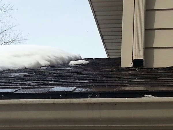
The sound of running water cascaded off rooftops and made music in downspouts, as a harsh winter's worth of snow and ice began to melt into history under 50-plus degrees of warmth.

Hyperactive bank thermometers soared into unfamiliar territory in recent months.
Create a More Connected Minnesota
MPR News is your trusted resource for the news you need. With your support, MPR News brings accessible, courageous journalism and authentic conversation to everyone - free of paywalls and barriers. Your gift makes a difference.

Four-foot snow drifts rapidly gave up weeks of accumulated winter snowfall today, as thousands of new lakes emerged in low spots and parking lots around Minnesota.

That's a quick look at the top weather story in Minnesota today, as temperatures soared above 50 degrees at many locations for the first time since mid-November.
53 degrees -- high at Minneapolis Airport Monday at 2:20pm (more than 15 degrees above average)
32 degrees -- low at MSP Airport Monday at 4:11 a.m. (first minimum at or above 32 degrees since Dec. 3)
Nov. 15 -- last day warmer than today at MSP Airport (56 degrees)
March 9 -- average first 50-degree temperature in spring at MSP Airport

Warmest day in nearly 4 months comes close to average
No doubt about it. The Chinook turbo-charged Pacific air mass over Minnesota delivered as advertised, and more, Monday.
While it seems like forever, it's interesting to note that the time interval between our last 50-degree temperature last fall and the first 50s this spring is very close to average.

Snow cover takes a hit
The conditions have been ideal. Temperatures in the 50s, higher March sun angle and a relatively dry air mass. That's a good recipe for melting, and evaporating more than 6 inches of snow cover from Minnesota in the past week. Take a look at Monday's NASA MODIS Terra 250 meter resolution shot over southern Minnesota.
You can see the back edge of snow cover now in west central Minnesota, with much of western and southwest Minnesota snow-free. I've highlighted some additional geographic features for reference.

Note the 'darker' urban landscape of the Twin Cities metro area. We've melted and 'dirtied up' enough snow around the Twin Cities to change the reflectivity or albedo of the snow cover. The darker surface reflects less incoming solar energy, and heats the air mass near the surface more efficiently. That's one reason temps were able to soar into the 50s Monday.
Spring flood outlook looks manageable in most areas
Lake Michigan ice record: Some effects in summer lake temps but little effect on spring temps
You'd think near record ice on the great Lakes would assure a cool spring on the lake shore. Not necessarily. Here's a great explanation from the Chicago office of the National Weather Service on just how this winter's ice affects spring weather in the big lake.
March Snow: Significant Midwest & New England snow swath but little or no accumulation in Boston
We awake to a wintery mix in the metro just in time for rush hour Tuesday morning. Southern Minnesota may pick up one- to two inches along the Interstate-90 corridor, so be aware of snow potential in southern Minnesota in the morning.
That's the tip of a much bigger storm that tracks east through the Midwest into New England by Wednesday. The storm slides from near and south of Chicago, to the north of Boston which expects little or no snowfall according to the local NWS.
Here's the Global Forecast System Kuchera Method outlook for snowfall.

The best shot at six to 12 inches of heavy wet snow? South of Chicago to Detroit, Cleveland, Buffalo and Upstate New York into New England.
Here's the latest web briefing from the Chicago NWS.
Keep an eye on this storm and possible track changes if you are planning travel east this week.
New MPR News Weather Page makes debut
I am very happy to be able to announce the brand new redesign for our MPR News Weather Page which debuted Monday.
I was thrilled to work with the skilled team of MPR developers and news web pros lead by Justin Heideman, Peter Rasmussen, Jon Gordon, Steve Nelson and many others. I believe we have significantly upgraded our online weather page for readers.
Here's a quick snapshot of the new look.

My priorities are simplicity and improved forecast accuracy with the new pages. I'm really pleased that we've included a new 'ensemble' of model forecasts into the new forecast products.

The combination of over two dozen of the best forecast models on the planet includes European, National Oceanic and Atmospheric Administration, Canadian, Short Range Ensemble Forecast and other high resolution forecast models and ensemble products.
[image]
This should greatly improve the accuracy of forecast on the MPR weather page -- and a more user-friendly design makes it easy to surf for the weather data you are looking for.
Links to the latest Updraft blog posts are just below the main forecast info.

MPR's Justin Heideman explains more on the development process.
Let us know what you think!