First sign of spring? Target Field turns on heated turf Monday
Spring anticipation
I love being a weatherman this time of year.
There are things that I can see before most, and it gives me great hope and buoyancy after the coldest Minnesota winter in 35 years. The weather maps look better every day.
I see more frequent gushes of milder air pulsating into Minnesota the next two weeks. The temperature peaks are getting higher on the weather graphics, and the valleys are inevitably moving up too. The weather maps now push 40 degrees on a warm day instead of 20. A cold day hovers in the 20s above zero instead of just below zero.
Create a More Connected Minnesota
MPR News is your trusted resource for the news you need. With your support, MPR News brings accessible, courageous journalism and authentic conversation to everyone - free of paywalls and barriers. Your gift makes a difference.
Progress.

Baseball weather?
The first real sign of spring in Minnesota?
It could be the day when Twins Head Groundskeeper Larry DiVito says it's time to turn on the heaters that lie beneath the Target Field turf.
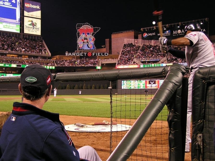
It's an interesting balancing act this time of year at Target Field. The heavy snow on the turf keeps the ground insulated and prevents frost from getting too deep. But at some point the snow must go, and the in-ground heaters get switched on to warm up the turf and green up the grass by Opening Day.

I asked Larry when the magic day will happen this year, and how he goes about getting the Twins Field of Dreams looking like July -- by early April.
Paul,
It all depends on the weather of course.
With no game until April 7th this year, I will need 3 weeks to get the grass going. I want to put my granular fertilizer down by March 20 or 21 to get it fed.
This week the overnight lows remain too cold for me to begin exposing the turf, so we are leaving the snow on the field this week, other than the warning track, which we cleared once already and will do so again.
Monday March 10th we will start taking snow off the field and turning up the heat at the same time. Once the initial snow removal is complete, the field heating should melt any fresh snow we get from there. Soil temperatures today are 32-33* F; I will get temps into the 40’s early next week and up to 62* F by March 20th.
Larry
Thanks Larry, I needed that.
Thoughts of green grass soon at Target Field are good tonic this time of year as I stare out the Weather Lab window at 4-foot snow drifts.
Clipper slides south

Our latest clipper favors southern Minnesota and northern Iowa overnight. The system grazes the metro with a snowy dusting, but the real accumulation favors the Minnesota River Valley and Interstate 90 corridor.
The late Tuesday afternoon radar shot from Minneapolis-St. Paul International Airport shows the trend of accumulating snow in southern Minnesota as the Twin Cities rides the edge of this system.

The National Weather Service in La Crosse, Wis., highlights overall accumulation trends.
[image]
Operation March thaw: warming trend kicks in next 48 hours
The weather maps still look encouraging for much milder temps in the next one to two weeks. The first push of significantly milder air arrives Thursday into Friday, as temperatures push 30 degrees in the Twin Cities metro area and southern Minnesota.
After a temperature speed bump into Saturday, the next warm front looks even milder. After a chilly start Sunday morning, 30s should gush into southern Minnesota again late Sunday -- and I see a very good shot at temps pushing 40 degrees by Monday afternoon in the metro and southern Minnesota.
The European Centre for Medium-Range Weather Forecasts model output for the next seven days may be a bit optimistic, but the trend seems irrefutably welcome looking at the maps.

Thank the Arctic Oscillation
If you are looking for someone to hug for our coming warming trend, I'm happy to be here for you. Otherwise, try the Arctic Oscillation.
We've endured a "negative phase" of the AO all winter. When the AO goes positive, Minnesota usually warms up. Here's the AO forecast going out the next two weeks. The positive trend in the AO suggests a robust and sustained warming trend.

The 16-day Global Forecast System output seems to support the notion of a much warmer pattern well into mid-March. We'll get some cooler puffs of air in between warm ups, but the overall trend is much warmer than what we've all endured the past three months.
Note the absence of any sub-zero temperatures, the string of days in the 30s to near 40 degrees, and the notion of relatively little rain/snow. Could spring truly be right around the corner this year?

Stay tuned and enjoy!