Dangerous wind chills Thursday make Minnesota the icebox of the nation
The earlier sunrises and the later sunsets are the most positive things I can offer on a day when wind chill readings are bitterly cold.
Wind chill advisories and warnings continue today over much of the northern tier of the country, extending from the Dakotas to western New York State.
Some of the coldest air temperatures are being reported in Minnesota at sunrise. Some air temperatures from the state at 7 a.m.: 35 below at Crane Lake, 29 below at Hallock and International Falls, 26 below at Staples and 14 below at Eden Prairie and Rochester.

Often the return of the cold is an indication of cold cloud tops. Over our neck of the woods it is likely returning the cold skin temperature of the Earth's landscape.
Create a More Connected Minnesota
MPR News is your trusted resource for the news you need. With your support, MPR News brings accessible, courageous journalism and authentic conversation to everyone - free of paywalls and barriers. Your gift makes a difference.
Temperatures will slowly recover today, but afternoon highs are likely to top out about 30 degrees shy of the normal. The normal high for International Falls for Feb. 27 is 27 degrees.

A nudge of less cold air will start to push into southwest Minnesota overnight. This is likely to form clouds and snow flakes over south central Minnesota on Friday. Temperatures are likely to climb a few degrees higher on Friday.
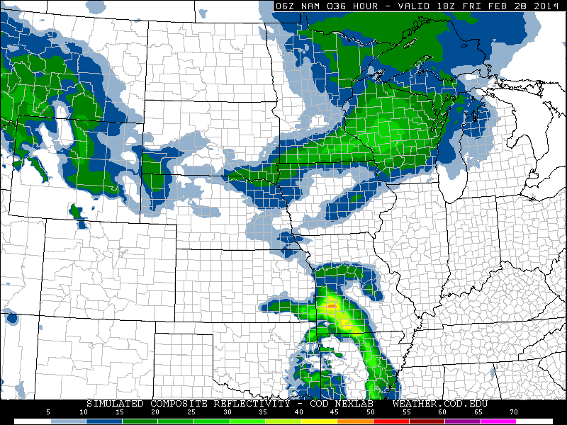
Snowfall may accumulate a couple of inches in southeast Minnesota and increase to as much as 4 inches in southwest Wisconsin Friday afternoon.
This simulated radar reflectivity for noon on Friday indicates the heaviest snow likely south of the Twin Cities. The lighter green color shows where the heaviest snow could be falling.

[image]
The jet stream driving the bitter arctic air south was nicely indicated on this graphic of the jet stream from the European Centre for Medium-Range Weather Forecasts from last evening.

The National Oceanic and Atmospheric Administration's Global Forecast System model shows the jet stream becoming more west than northerly next Wednesday. Milder temperatures are seen by the middle of next week.

Forecast highs for next Thursday:

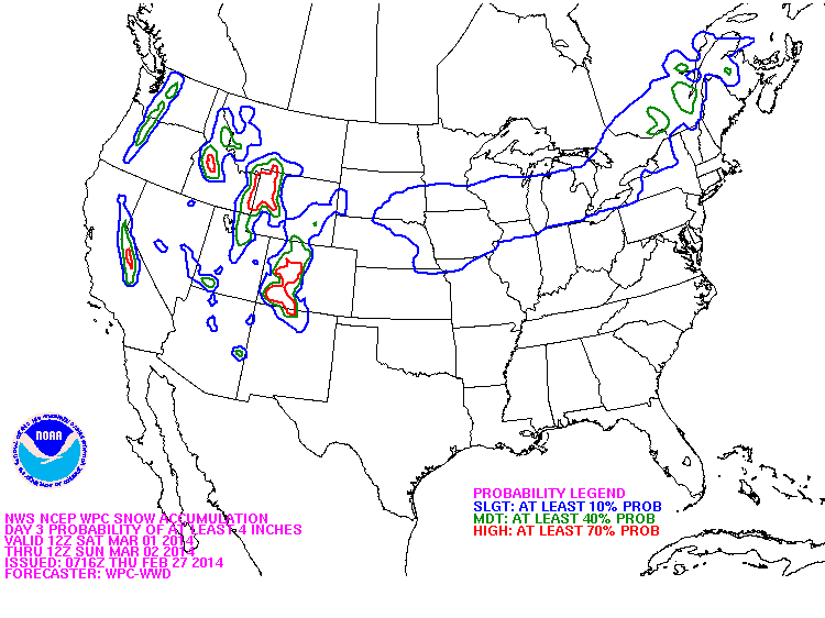
Another weather maker could lay down more snow in southern Minnesota on Saturday. Here's an early outlook for accumulating snow from the Weather Prediction Center.