Seasonably mild for Friday; cold front arrives late Saturday
International Falls, Minn., had a nice "warm-up" on the thermometer today. Early morning readings had dipped to 24 below zero. At 3 p.m., the temperature had climbed to 6 above at the Falls.
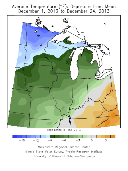
It has been a very cold month of December over much of the region. The average temperature so far this December at International Falls is running 14 degrees below normal. There's a good possibility that this will be the second coldest December on record at the Ice Box of the Nation.
This afternoon's visible satellite image, in black and white, almost gives the impression of the moonscape. The clear skies in far northeast Minnesota nicely depict the Superior National Forest.

A warm front is expected to push into the state later tonight. If we get some breaks in the cloud cover on Friday we could see some of the warmest readings of the month. On Dec. 2, the mercury topped out at 38 degrees in Minneapolis-St. Paul International Airport.
Create a More Connected Minnesota
MPR News is your trusted resource for the news you need. With your support, MPR News brings accessible, courageous journalism and authentic conversation to everyone - free of paywalls and barriers. Your gift makes a difference.
We'll flirt with 40 degrees on Friday afternoon.

There is sufficient snow cover for recreation across the upper Midwest. Friday and Saturday should be quite nice for skiing and snowmobiling. A bit of a breeze on Friday could create a wind chill.

A closer look at the snow depth indicates more than two feet of snow in northeast Minnesota and the rim of Lake Superior.

Models are suggesting the most likely area to accumulate snow on Saturday afternoon and night will be in far northeast Minnesota and Upper Peninsula Michigan.
Arctic air will ride in on strong northwest wind on Sunday. The cold air is expected to settle over Minnesota and Wisconsin as we close out 2013.

The deeper red color paints temperatures of 25 below zero.
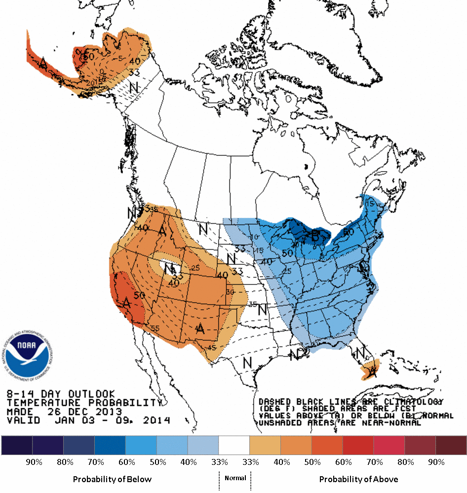
The latest medium range outlook from the National Oceanic and Atmospheric Administration's Climate Prediction Center favors below normal temperature through the first part of January 2014.