Real winter begins: Snow, cold and biting winds on the menu
Dec. 1 marks the beginning of the meteorological winter. Right on cue, Mother Nature looks to deliver a smack of snow and cold that will get your attention this week. Hope you've been preparing. You'll recall that last winter our snow season extended into May.
Early this morning scattered areas of light snow or light snow mixed with sleet were showing up on Doppler radar.

The morning infrared satellite image did not paint much in the way of an organized system over Minnesota. Snow and sleet should be passing through today with a break in the action in southern Minnesota this evening. Some locations may see an inch or two of snow this morning through mid afternoon, including the north and eastern Twin Cities metro area.

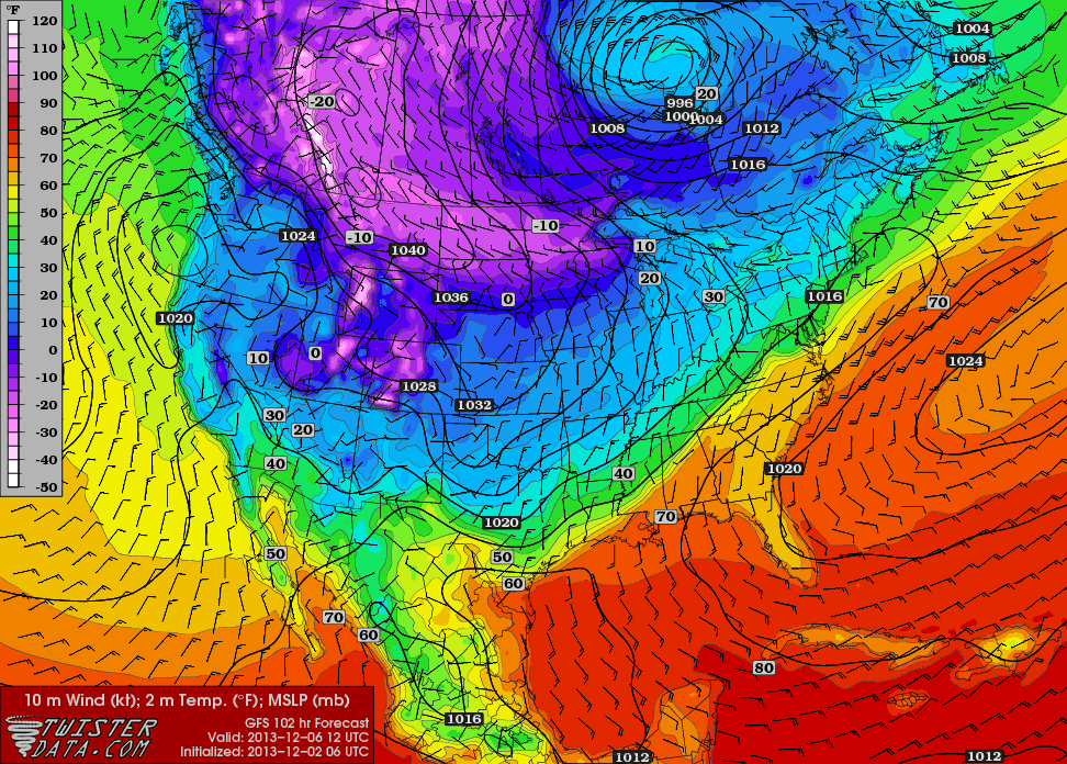
Computer models have been rather inconsistent on the movement and development of a low pressure in the Midwest.
Create a More Connected Minnesota
MPR News is your trusted resource for the news you need. With your support, MPR News brings accessible, courageous journalism and authentic conversation to everyone - free of paywalls and barriers. Your gift makes a difference.

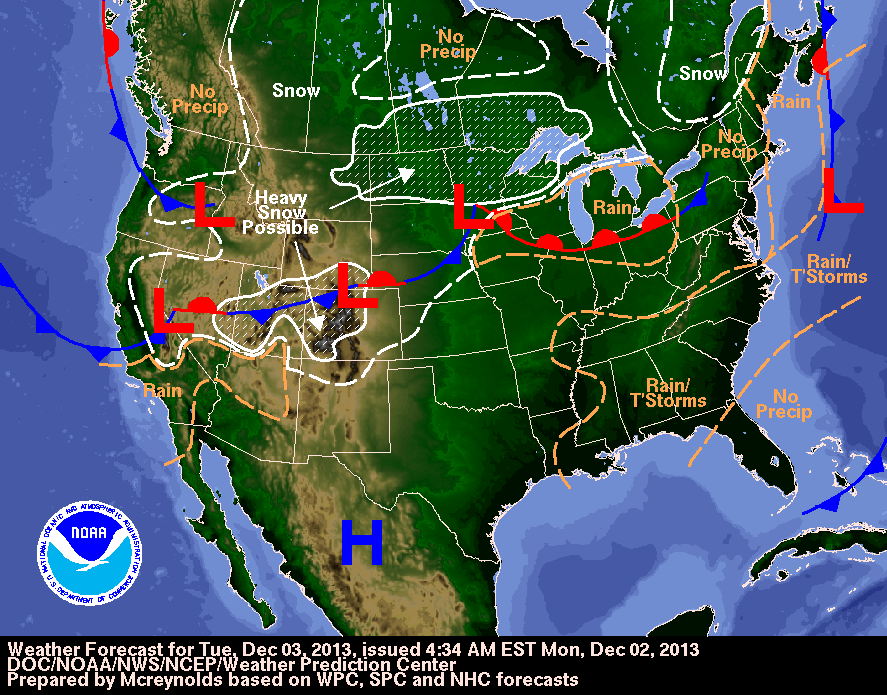
Winter storm watches for the potential of heavy snow have been issued by the National Weather Service that includes an area from Fargo-Moorhead to about Rice Lake, Wis. and points north. See more details on the weather developing across the northern half of the country for wintry weather forecasts.
Meteorologists at the National Oceanic and Atmospheric Administration's Weather Prediction Center paint a high probability of 8 inches or more of snow in northern Minnesota by noon on Wednesday.

The Duluth Office of the National Weather Service this morning has outlined the area currently believed to be in line for the greatest snow accumulation.
[image]
Heading northwest on Tuesday into Wednesday will be very difficult as snow falls and increasing northwest winds result in blowing and drifting snow. If travel plans take you into western Minnesota and the eastern Dakotas you'll want to pay close attention to the weather conditions.
Falling temperatures and gusty winds follow in the wake of the snow.
[image]
Biting cold temperatures are expected to last into the weekend. Snow cover and clearing skies in the overnight hours, along with diminishing winds could bring some morning lows as cold as 20 below zero.