Light snow far north and south; coldest temperatures of the season
Friday evening and overnight snow accumulated up to four inches in far northeast Minnesota. Chilly temperatures over the weekend allowed snow cover to remain, though down to only an inch or two from International Falls to Ely.

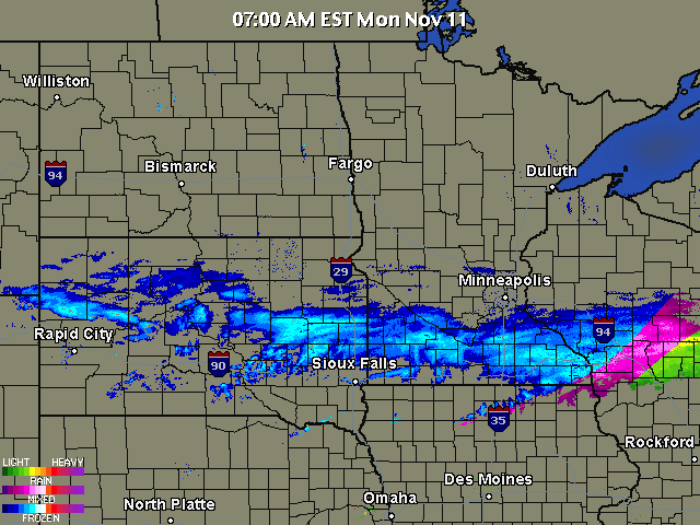
A band of light snow developed very early this morning and was moving steadily through southern Minnesota. Accumulations will be generally less than an inch. Snow exits into southern Wisconsin well before noon.
[image]
Very chilly air, the coldest of the season, will settle over the region tonight. Northwest winds sweeping over the relatively warm water of Lake Superior will induce lake effect snow. A couple of inches of fluffy snow may accumulate on the southern shores of the big lake during the next 24 hours.
Create a More Connected Minnesota
MPR News is your trusted resource for the news you need. With your support, MPR News brings accessible, courageous journalism and authentic conversation to everyone - free of paywalls and barriers. Your gift makes a difference.
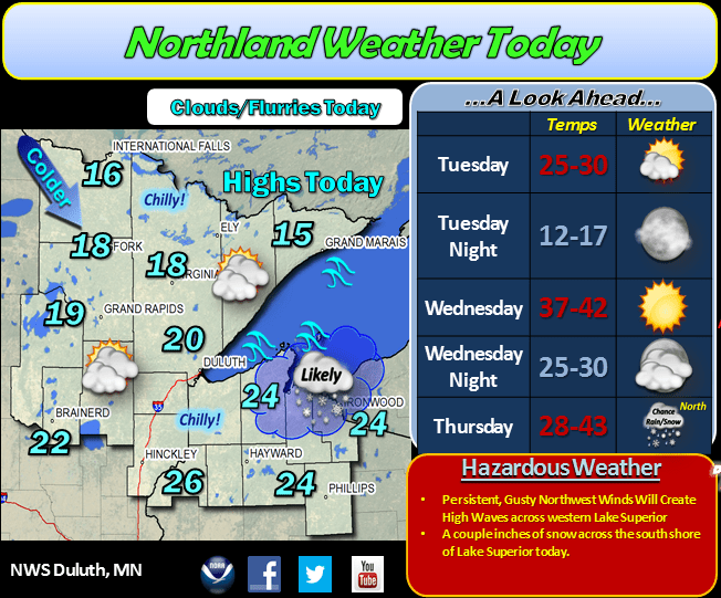
As winds decrease overnight temperatures will fall to single digits in northern Minnesota. Some locations could drop below zero.

This is the anniversary of the Armistice Day Blizzard. The Minnesota State Climatology Office rated this storm Minnesota's second most significant weather event of the 20th century, behind only the 1930s Dust Bowl.

Details of this deadly storm are provided by the Minnesota Climatology Working Group.
Here is the track of the surface low pressure that pulled moisture up from the Gulf of Mexico, colliding with incoming cold air from the north to create the blizzard that dumped over 26 inches of snow at Collegeville in central Minnesota.

The huge weather story over the weekend was the tragic death toll and destruction in the Philippines. Super Typhoon Haiyan was well forecast but one of the most powerful storms ever recorded.

More information about the typhoon is available from National Public Radio News.
Honor the nation's veterans today. Freedom is priceless.