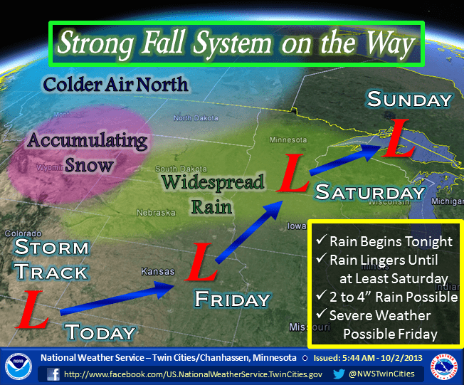
Major fall storm arrives tonight, 2″ to 4″ rainfall, growing Friday severe risk
There's action in the weather lab these days.
The first major storm of fall is heading in. The storm is still in the developmental phase today so the finer details are in flux, but the big picture remains the same. Expect rain that will be heavy at times, wind, cooler temps starting tonight and lingering into Sunday.
Here's a breakdown on what looks like the biggest rainmaker since at least June 21st (2.5 inches at Minneapolis-St. Paul International Airport) for much of the Upper Midwest.
Winter type system
Create a More Connected Minnesota
MPR News is your trusted resource for the news you need. With your support, MPR News brings accessible, courageous journalism and authentic conversation to everyone - free of paywalls and barriers. Your gift makes a difference.
If this were winter, the weather headlines would be blaring talk about a foot of snow for parts of Minnesota, maybe two feet in some spots. No doubt about it, this system will develop into a wrapped up and powerful fall season storm.
The storm track from Kansas toward the Twin Cities is favorable for pulling in plenty of Gulf moisture, and wringing it out as rainfall over Minnesota. There may be some accumulating snows on the far west side of the system in the Black Hills, Wyoming and Montana, but all major models indicate this system is just too warm for snow in Minnesota.
It's already raining in the Red River Valley today, and that rain will spread east into the Twin Cities by tonight.

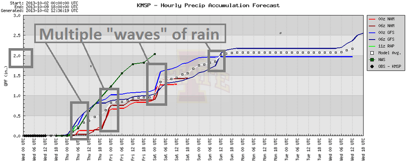
The rain comes in waves into Sunday. It may not rain all the time, but multiple waves of rain will fall. Some of the rainfall may be heavy at times. Have you cleaned those leaves out of your gutters yet?
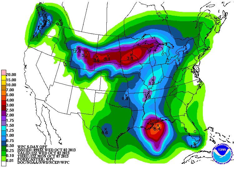
Here's the rainfall outlook from the National Oceanic and Atmospheric Administration's Weather Prediction Center, which places a 3.8 inch rainfall bull's-eye right over the Twin Cities in the next few days. If the 2 inch to 4 inch rainfall totals pan out, it will pretty much erase the drought in parts of Minnesota by early next week.
Growing Friday severe risk
Some of the models (most notably NOAA's North American model) take the center of low pressure just west of the metro Friday. If that happens, an active warm front will spark storms east of the low. There is a growing risk those storms could be severe Friday afternoon and evening. If the front lays out near the Twin Cities and southeast Minnesota, we could see severe storms.
I'm a little concerned about the amount of low level wind shear available late Friday near the frontal zone. It's too early to pinpoint severe risks, but if the shear develops as some models are suggesting the spinning winds could produce a few tornadoes. A rare October tornado in Minnesota? It's not out of the question late Friday.
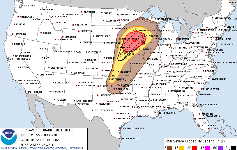
Here's Friday's severe risk area from NOAA's Storm Prediction Center. The Twin Cities is included in the slight risk zone.
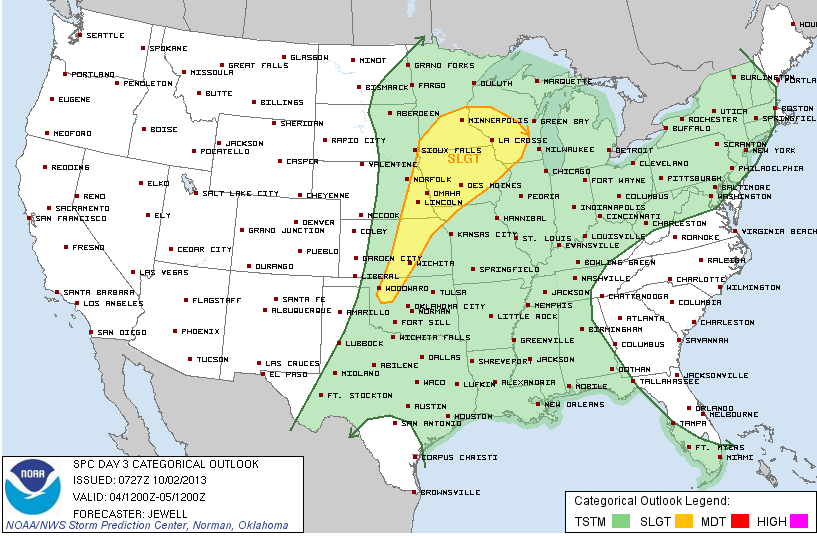
NOAA's SPC puts the risk of severe storms at 30 percent late Friday for much of southern Minnesota and Iowa.
No big hurry to leave
This looks like a four day system for Minnesota. There are some indications the system may linger into Sunday morning. Here's the Euro model data from Weatherspark.

Bottom line: Get ready for significant rain and cooler temps into the weekend. The totally next sunny and dry day after today looks like Monday. Naturally!